

Latest Weather Blog
Wednesday AM Forecast: Warm days ahead, Rain chances return for the weekend
The Storm Station 7-day forecast shows the warm Spring temperatures continuing through the end of March, with a few rounds of showers and storms entering the forecast over the weekend.
Today & Thursday: Areas of patchy fog may develop around sunrise Wednesday before partly sunny skies take over for the rest of the day. Warm conditions continue today and tomorrow with mild morning lows in the 60s and afternoon highs in the low to mid-80s. Besides a stray shower in northern regions of the WBRZ coverage area Wednesday afternoon, the Capital Region will remain dry over the next 48 hours. Clouds will begin to increase Thursday ahead of a weekend rainmaker.
Up Next: A more unsettled pattern will take over this weekend as a stronger storm system forms over southern Texas and moves up the Gulf coast. A few rounds of shower and storms will be possible from the Friday afternoon to Monday timeframe. The first batch of showers will begin to move into the Capital Region Friday afternoon, peaking in coverage overnight, and clearing the area during the day on Saturday from west to east. During that timeframe, heavy downpours could result in a quick 1-2" of rainfall. The threat for severe weather Friday night remains unlikely. Those with outdoor activities Friday evening and Saturday morning should monitor the forecast closely in the coming days.
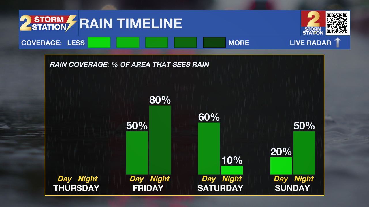
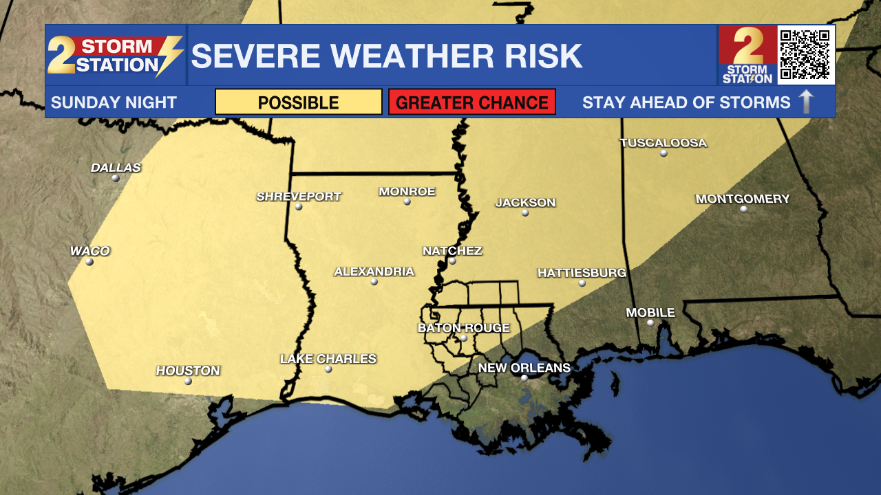
Once the rain moves out on Saturday, the rest of the weekend will be majorly dry with only a few isolated storms possible. Look for highs near 80 degrees Saturday and well in the middle 80s on Sunday. Sunday will see plenty of dry time and sunshine ahead of another approaching storm system, this one will move in from the north and bringing a slightly greater chance for strong to severe weather. The late weekend system looks to arrive Sunday night into Monday morning and could impact the Monday morning commute. A better idea of threats and timing will come into view in the coming days so continue to check back in with the Storm Station for the latest details.
The forecast early next week calls for ongoing mild temperatures and spotty showers and thunderstorms. However, that will strictly depend on whether the front stalls or makes a clean swipe through Louisiana and Mississippi.
Trending News
Get the latest 7-day forecast and real-time weather updates HERE.
Watch live news HERE.
– Emma Kate C.
The Storm Station is here for you, on every platform. Your weather updates can be found on News 2, wbrz.com, and the WBRZ WX App on your Apple or Android device. Follow WBRZ Weather on Facebook and X for even more weather updates while you are on the go.
More News
