

Latest Weather Blog
Sunday PM Forecast: Strong storms, then a sudden drop in temperatures
A strong cold front is about to kick the warm, spring-like feel out of the area. After a thin line of thunderstorms sweeps through late Sunday, a brisk northwest wind will usher in a significant cooldown for the Gulf Coast.
Tonight & Tomorrow: A cold front will drive a strong line of storms into the area late. Once they pass, expect a cold wind to take over on Monday. Starting off in the 40s, temperatures will only find the mid-50s by Monday afternoon. Multiple weather impacts are expected Sunday night into Monday:
Strong Storms – Cloud cover will increase during the evening as the cold front approaches, with spotty showers firing after 8 p.m.. Leading up to midnight, a thin line of showers and thunderstorms, some potentially strong, will move through. This “quick-hitter” will clear east of I-55 not too long after midnight.
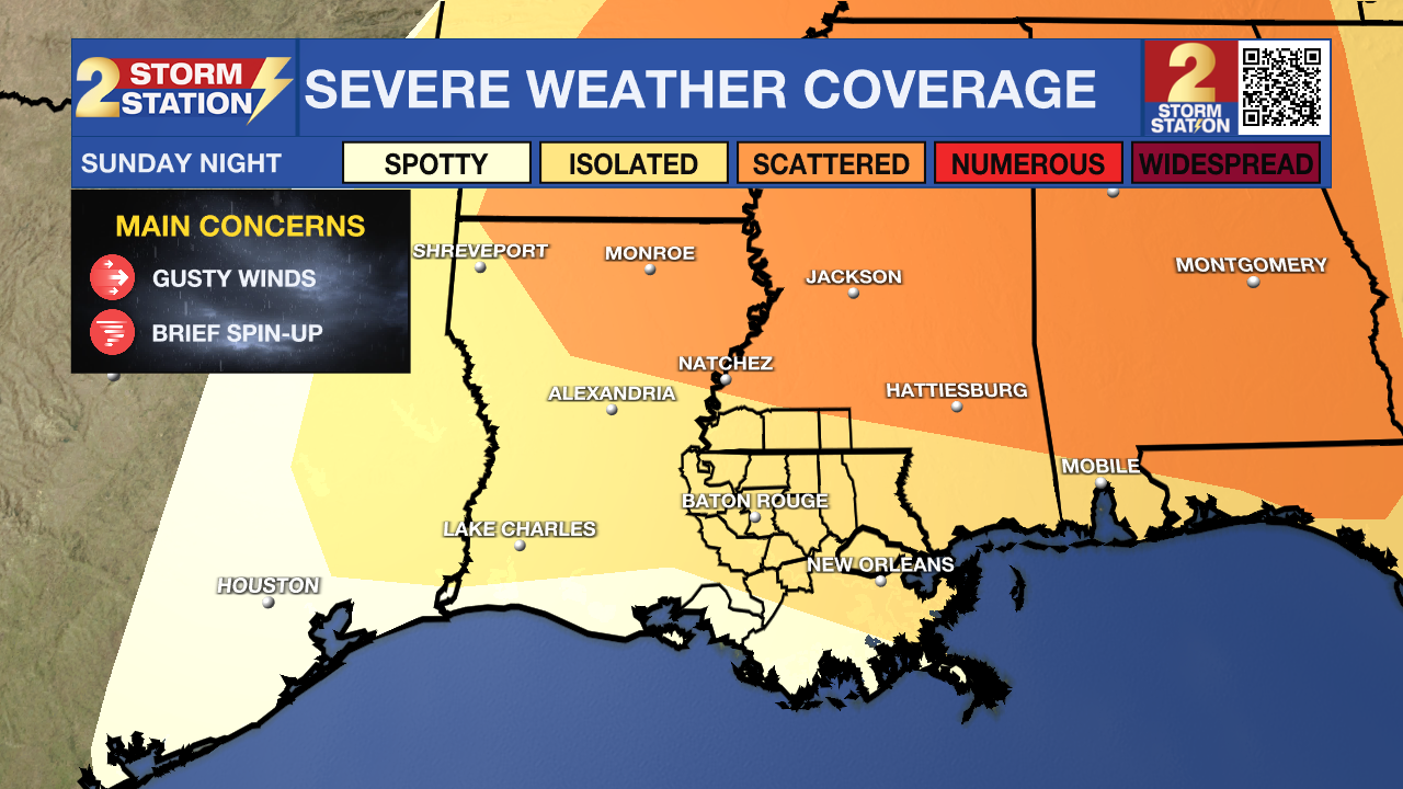
While the strongest activity is likely to remain well north and weaken as it nears I-10, much of the Capital Area remains under a Level 2/5 “slight” risk of severe weather. This setup supports a few gusty storms and the possibility of a brief, spin-up tornado. Please stay weather-aware tonight, download the Storm Station Weather App, and ensure your alerts are turned on to receive any immediate warnings.

Strong Winds – The wind will be noticeable on Monday. Overnight, northwest winds at 15-25 mph with gusts topping 35 mph will take over once storms pass. The brisk wind will carry over throughout much of Monday. Go ahead and secure loose outdoor items if not already completed.
Trending News
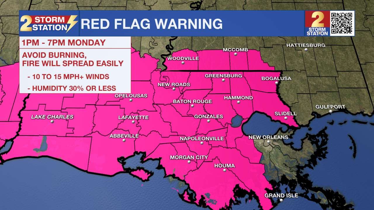
Fire Weather Danger – A Red Flag Warning has been issued for all of southeast Louisiana from 1 p.m. to 7 p.m. Monday. The combination of winds over 15 mph and very dry air will promote rapid widespread spread, should anything ignite. Avoid burning outdoors, dispose of cigarettes properly, and remain cautious while using equipment that can spark.
Significantly Colder – Jackets or heavier coats will be needed by morning, with wake-up temperatures in the 40s. The breeze will place wind chills into the upper 30s. After early clouds clear out, a mixture of sun and high clouds will warm highs into the mid-50s — significantly below average for late winter.
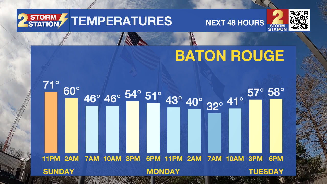
A Few Flakes? – If any sprinkles linger past dawn, don’t be surprised to see a few flakes mixing in. That said, most won’t come across those, and they certainly wouldn’t stick. By Monday afternoon, enough dry air invades to cut precipitation chances down to zero.
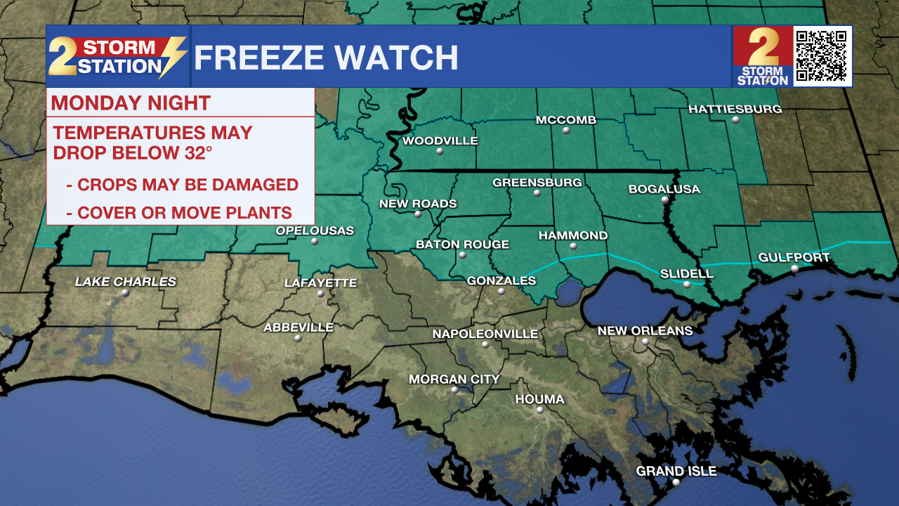
Up Next: The coldest part of the Storm Station forecast comes early Tuesday. A light freeze is expected along and north of I-10/12, with frost conditions south of the highways. Those who have planted their spring gardens will need to take action to protect plants. People and pets will also need a warm shelter. A Freeze Watch has been issued for areas north of I-10/12 on Tuesday morning, likely to be upgraded to a Warning later in time.
Temperatures will gradually moderate throughout the rest of the workweek, with generally dry conditions prevailing. As the week wraps up and spring begins, expect highs to return to the 80s.

Get the latest 7-day forecast and real-time weather updates HERE.
Watch live news HERE.
— Meteorologist Malcolm Byron
The Storm Station is here for you, on every platform. Your weather updates can be found on News 2, wbrz.com, and the WBRZ WX App on your Apple or Android device. Follow WBRZ Weather on Facebook and X for even more weather updates while you are on the go.
More News
