

Latest Weather Blog
Saturday PM Forecast: Rain chances on the rise, a few areas to watch in the tropics
After a very dry Saturday, rain chances will rise for the 2nd half of the weekend and into next week. In the tropics, there are a few areas that could develop, with one of those very close to home.

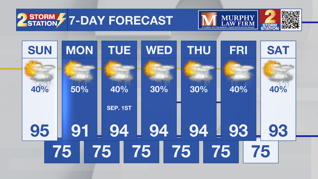
Tonight & Tomorrow: It will be a mostly clear night with lows near 74°. Sunday will start off clear and quiet. Highs will eventually reach the mid-90s, but increasing humidity will make that feel closer to 106°. Higher humidity also means more moisture, which will drive storm chances higher. Into the afternoon and evening, isolated showers and storms will develop. Not everyone will get wet, but heavy rain and gusty winds will be possible in a few locations.
Up Next: Atmospheric moisture gets even higher Monday, possibly lasting into Tuesday as a Gulf disturbance passes close by. This will send storm chances even higher, but still, no washouts are expected and not everyone will get wet. Although the best chance of rain will be in the PM hours, some AM activity cannot be ruled out. A very typical pattern resumes for the rest of the week. This means you can expect, heat, humidity, and isolated PM storms.
Trending News
Get the latest 7-day forecast and real-time weather updates HERE.
Watch live news HERE.
The Tropics: Cloudiness and showers associated with a weak low pressure area in the northern Gulf have become a little better organized since yesterday. Some additional slow development of this system is possible during the next few days as it drifts westward.
Meanwhile, disorganized showers and thunderstorm continue in association with the remnants of Tropical Storm Dolly, located about 300 miles east of the Leeward Islands. However, there are no signs that the system is developing a closed circulation. Redevelopment of this system is unlikely while it moves westward to west-northwestward near 25 mph. The wave could bring locally heavy rains and gusty winds to portions of the Leeward Islands, the Virgin Islands and Puerto Rico over the next several days.

– Balin
The Storm Station is here for you, on every platform. Your weather updates can be found on News 2, wbrz.com, and the WBRZ WX App on your Apple or Android device. Follow WBRZ Weather on Facebook and X for even more weather updates while you are on the go.
More News

