

Latest Weather Blog
Friday AM Forecast: Ending June with more excessive heat
Very summerlike behavior continues as we head towards the first week of July. Expect high heat and daily pop-up storm chances.
Today & Tonight: Spotty early morning showers will gradually taper off through the morning commute hours. Friday will see partly sunny skies and temperatures that warm into the low and mid 90's. Feels-like values will stay below heat advisory criteria again today but nevertheless it will be very muggy and hot. Isolated showers and storms will begin to pop-up around the region this afternoon through early evening, diminishing in coverage after sunset. Overnight, we will see partly cloudy skies and temperatures that barely dip into the 70's.
Up Next: Partly sunny skies and afternoon pop-up storm chances can be found every day on the Storm Station 7-day forecast. Also found, high afternoon temperatures nearing 100° on Sunday and Monday. With no lack of humidity in the air, feels-like temperatures are expected to reach 108°+ those days and would prompt more Heat Alerts for the area. The only relief from the heat will be offered by the hit-or-miss storms each day. The 4th of July forecast looks to continue the heat streak, with any isolated storms likely to diminish before the Baton Rouge firework show that evening. Make sure to check back in with the Storm Station for the latest as we get closer to Independence Day.
The Tropics: Tropical Depression Two has formed in the Tropical Atlantic over 1000 miles east of the Windward Islands. This system is moving west, toward the Caribbean Sea. You can read the latest on this system HERE.
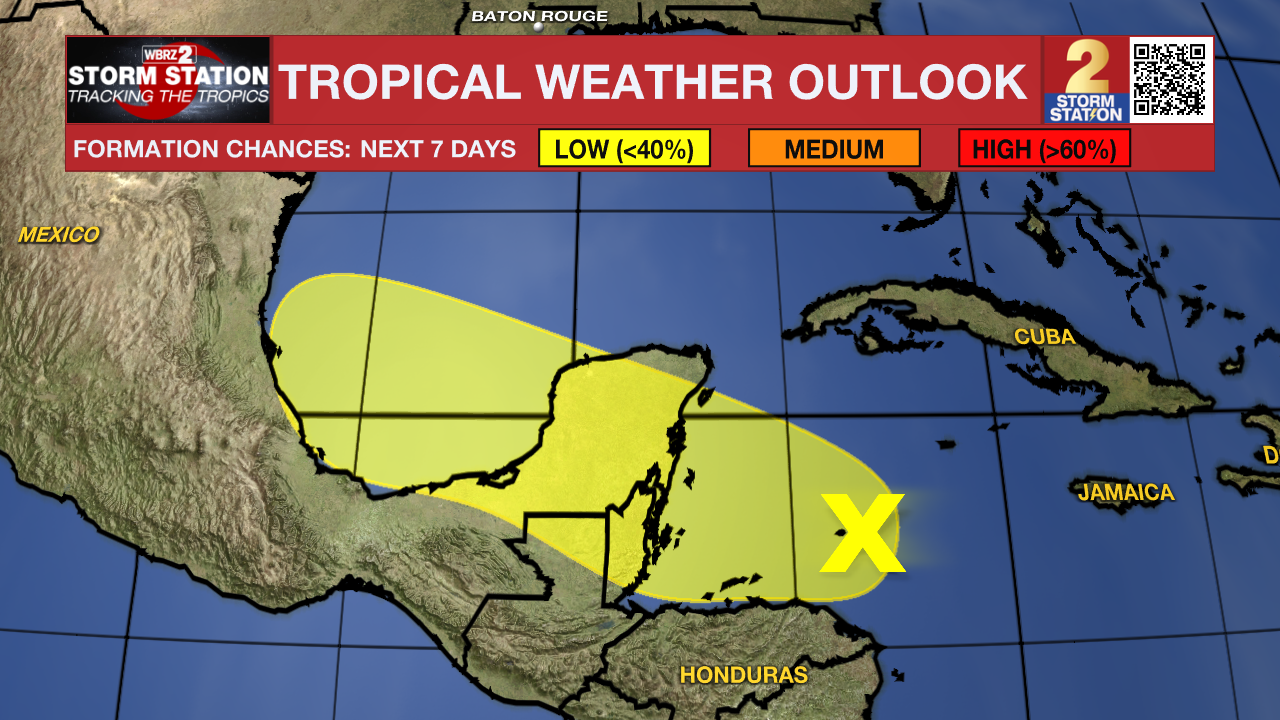
Another broad area of low pressure over the western Caribbean Sea is still fairly disorganized. Some development of the system is possible over the northwest Caribbean Sea or southwest Gulf of Mexico in the next few days. However, overall odds of the system acquiring tropical characteristics is low per the latest outlook. Regardless, Louisiana will see no impacts from this system.
Trending News
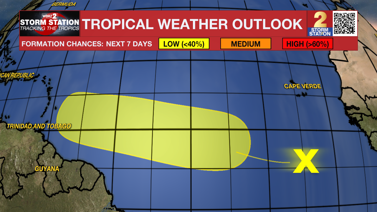
NEW Friday morning: A third area of disorganized showers and storms has initiated off the coast of Africa and is forecasted to travel west-northwest. Some slow development of this system is possible early next week however at this time, tropical development with this system remains low over the next 7-days.
Get the latest 7-day forecast and real time weather updates HERE.
Watch live news HERE.
- Emma Kate Cowan
The Storm Station is here for you, on every platform. Your weather updates can be found on News 2, wbrz.com, and the WBRZ WX App on your Apple or Android device. Follow WBRZ Weather on Facebook and Twitter for even more weather updates while you are on the go.
More News
