The hottest stretch of the summer continues across the Capital Region with heat index values climbing as high as 115 degrees through Wednesday. While only a stray afternoon storm is possible over the next couple of days, rain chances increase late this week and into the weekend, bringing some relief from the extreme heat.

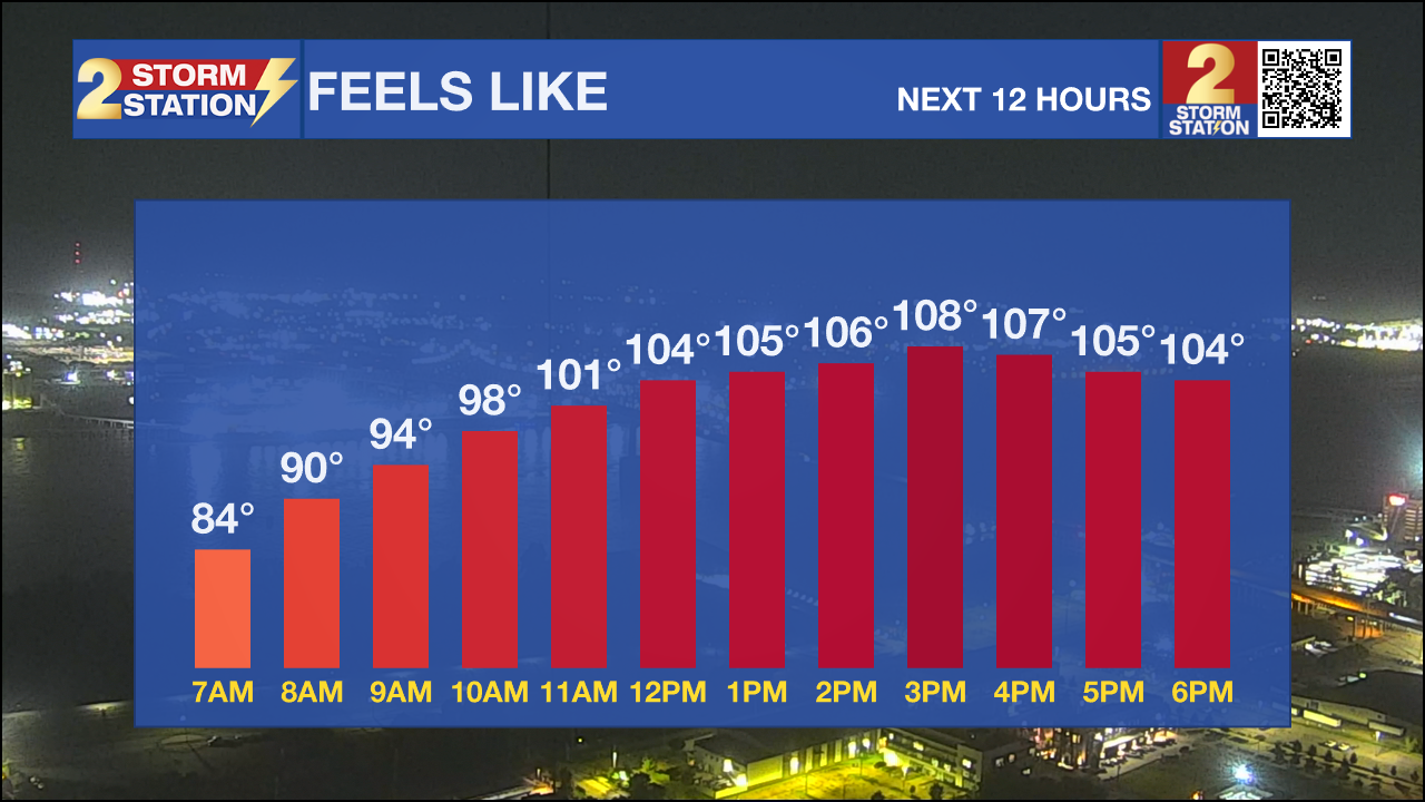
Today and Tonight: Expect another dangerously hot day with afternoon temperatures in the mid to upper 90s and heat index values between 110 and 115 degrees. A Heat Advisory remains in effect for the Baton Rouge area, while locations farther east are under an Extreme Heat Warning. Most of the area stays dry, although an isolated late-day storm can't be ruled out, mainly east of Baton Rouge. Warm and muggy conditions continue tonight with lows only falling into the upper 70s.
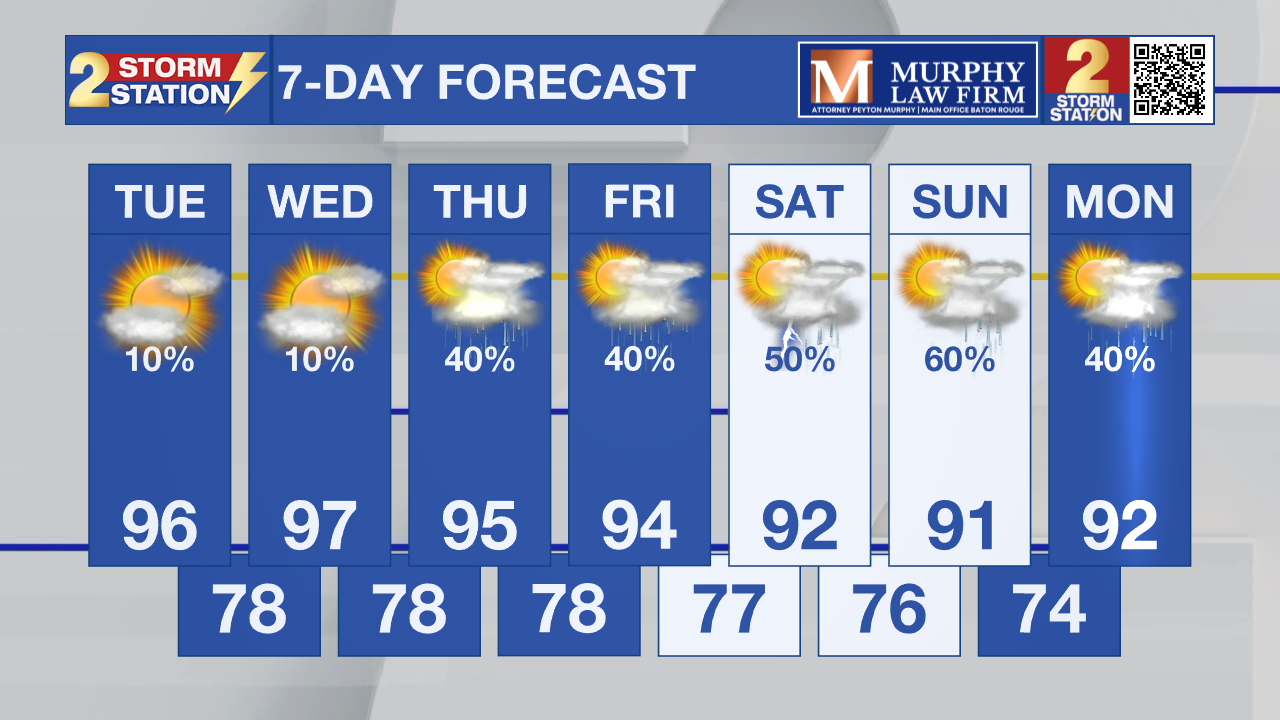
Up Next: Wednesday will be another day of dangerous heat, with heat alerts likely continuing across much of south Louisiana. Isolated afternoon storms remain possible, mainly east of Baton Rouge, but most communities will stay dry through midweek. By Thursday and Friday, scattered thunderstorms become more common as the summer ridge weakens. The greatest chance for widespread rain arrives this weekend, which should help knock temperatures back closer to normal while bringing the potential for locally heavy rainfall and gusty storms.
Tropics: The tropics remain quiet, and the National Hurricane Center is not expecting any tropical cyclone development anywhere across the Atlantic Basin during the next seven days.
Get the latest 7-day forecast and real-time weather updates HERE.
Watch live news HERE.
– Dave
The Storm Station is here for you, on every platform. Your weather updates can be found on News 2, wbrz.com, and the WBRZ WX App on your Apple or Android device. Follow WBRZ Weather on Facebook and X for even more weather updates while you are on the go.