

Latest Weather Blog
Wednesday PM Forecast: Storm chances set to ease in the coming days
Though storms remain in the forecast, finding more dry time outside may prove to be an easier task as the weekend draws near. Just keep in mind that the heat and humidity aren’t going anywhere, at least until a front tries to move in early next week.
Tonight & Tomorrow: Afternoon showers and storms will linger into the evening, with off-and-on activity possible overnight. There is a chance that these storms could bleed over into the morning commute, so be sure to check in with Meteorologist Balin Rogers on 2une-In before leaving home. Morning lows will stay mild in the low to mid-70s.

The forecast for the rest of Thursday is proving to be challenging. At first glance, the setup supports additional thunderstorms as an upper-level disturbance taps into tropical moisture. However, forecast guidance is also hinting at a narrow corridor of dry air about 10,000 to 15,000 feet up moving directly over the Capital Area. This is known as a dry slot and could choke storm development, despite plenty of moisture at other levels in the atmosphere. Thursday will end up much drier if it ends up dominating, but if the dry slot fizzles out, storms will easily develop. Given the uncertainty in its strength, the Storm Station is holding rain coverage at 60% for Thursday — prepare for storms, but don’t be surprised if the afternoon ends up sunnier with only spotty storms. Look for a high in the mid-80s, though a drier day would allow highs to sneak into the upper 80s.

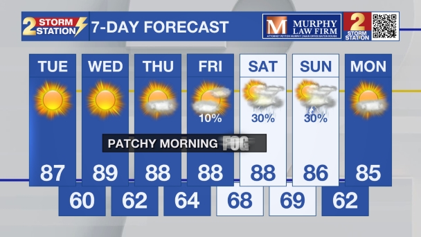
Up Next: The dry slot shouldn’t be an issue on Friday, so scattered storms will have an easier time firing in the heat of the day. Those storms would be the more typical, garden-variety activity, so there will still be plenty of dry moments. The pattern turns quieter into Saturday, with nothing more than an isolated pop-up storm. The boost in sunshine and lack of rain will push temperatures toward the 90° mark. Be sure to stay plenty hydrated and apply sunscreen if heading out to the pool or mowing the lawn. By Sunday and Monday, look for a slight increase in the number of showers and storms as a frontal system gets close to the area. There are even some signs that the front might briefly pass and stall by the coast early next week. Such a scenario would take down rain chances again by midweek and take the humidity down a notch.
Trending News
Get the latest 7-day forecast and real-time weather updates HERE.
Watch live news HERE.
— Meteorologist Malcolm Byron
The Storm Station is here for you, on every platform. Your weather updates can be found on News 2, wbrz.com, and the WBRZ WX App on your Apple or Android device. Follow WBRZ Weather on Facebook and X for even more weather updates while you are on the go.
More News

