Wednesday Evening Video Forecast
Related Story
After a warm end to 2024, 2025 is beginning on a seasonably cool note. Although quiet for now, the next impact in the form of showers and storms arrives late this weekend. Afterward, the much-advertised winter chill bulldozes into the region.
Tonight & Tomorrow: With a relatively cooler air mass finally becoming established, chilly temperatures are in store for the night ahead. Clear skies and generally light winds will result in a fast temperature drop after dusk. Morning lows will be near 38° in Baton Rouge on Thursday. Afternoon highs will be seasonable, reaching the mid-60s under mostly sunny skies. Low clouds will begin arriving from the southwest late in response to an organizing frontal system in the Gulf of Mexico. There might be just enough lift to produce some patchy areas of drizzle or light rain on Thursday night. This will not result in a significant rainfall, as many might struggle to pick up a measurable amount.
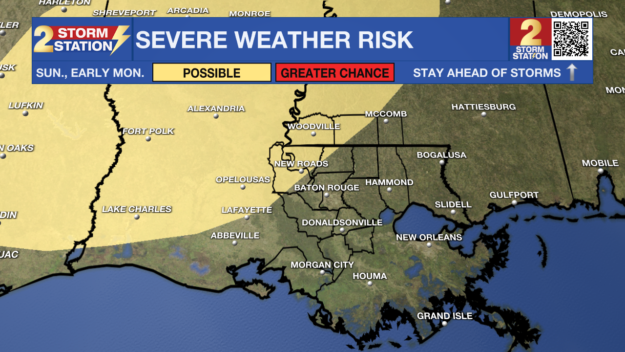
Up Next: Spotty areas of rain will push offshore early Friday, leaving behind a sunny sky for the remainder of the day. Highs again will reach the 60s, a theme which appears to hold true through Saturday. Afterward, the next weather impact arrives. A warm front will slide through the area on Sunday, boosting humidity and allowing highs to jump well into the 70s. The added warmth and moisture will give way to widespread showers and storms by Sunday night, a few of which could reach severe thresholds. The Storm Prediction Center has highlighted part of the state for having a severe weather risk during this timeframe. While exact details are still unclear, it is something to monitor closely in the coming days. Up to 1" of rain is possible with this system.

A trailing cold front will sweep the rain out early Monday. This will be a strong front, as the coldest air of the season arrives behind. The Storm Station 7-Day Forecast shows several days where highs sit in the near 50° with lows at or below freezing. Although beyond the scope of the Storm Station 7-Day Forecast, there have been some hints in the data of a frozen precipitation potential by the end of next week. Precipitation type, let alone if it can even occur, is unknown at this point as it's too far out to know. But if moisture can properly overlap with the coolest air, precipitation of the frozen variety is not off the table. Stay connected especially into next week as these details come into focus.
Get the latest 7-day forecast and real time weather updates HERE.
Watch live news HERE.
-- Meteorologist Malcolm Byron


