Tuesday Evening Video Forecast
Related Story
Cooler air will make its presence known just in time for 2025. Those out and about for New Year's Eve celebrations will want to consider bringing an extra layer. It's not a short-lived cooldown either, as the beginning of January looks to remain on the cool side.
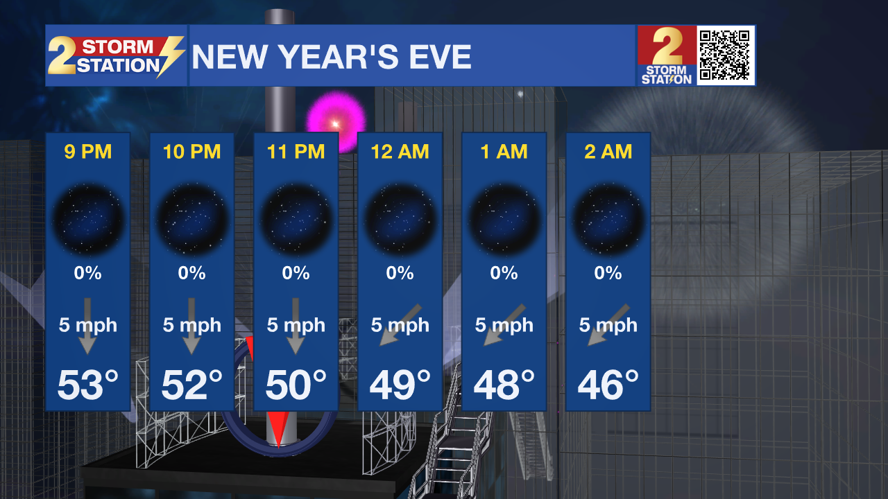
New Year's Eve: Dry air has already arrived, which eliminates any overnight fog potential. Aside from firework smoke, skies will remain clear for New Year's Eve celebrations. Cooler weather will finally make an appearance, with temperatures quickly falling after dark. Look for a temperature in the upper-40s around midnight as we ring in the new year. By daybreak, temperatures will hover in the low-40s.

New Year's Day: Temperatures will be seasonable from start to finish on the first day of 2025. Afternoon highs will reach the low to mid-60s - right around average for early January. Sunshine will be plentiful, although a few high clouds might mix in at times.
Up Next: The rest of the week will feature highs in the 60s and a mixture of 30s and 40s for lows. That's not out of the ordinary for January. Precipitation will be limited through Saturday, although there is a small chance to see some patchy drizzle or a spotty light shower on Thursday night. The better rain chance comes late this weekend. A warm front will slide through on Sunday, opening the door for a few showers. Then, a line of showers and thunderstorms appears to pass late. These storms could drop up to 1" of rain, and a few storms could be strong. A cold front will sweep the rain out early Monday. The exact timing of the system might shift around slightly in the coming days, but sometime during the Sunday-Monday timeframe, rain is likely.
There is high confidence that some really cold air, the coldest of the season, to push into the region behind the late weekend storm system. By Tuesday, lows could be near freezing with highs in the 40s and 50s. While beyond the scope of the Storm Station 7-Day Forecast, cooler weather looks to remain all through next week. Some guidance has also hinted at a small chance of frozen precipitation by the end of next week. It's a minor signal as of now, and far from a guarantee. But it's not off the table if moisture can properly overlap with the colder air mass. That would bring impacts to the area should that occur, which is why it will be important to monitor the latest Storm Station forecast in the coming days.
Get the latest 7-day forecast and real time weather updates HERE.
Watch live news HERE.
-- Meteorologist Malcolm Byron


