

Latest Weather Blog
Thursday morning video forecast
Related Story
The current heat streak we are in shows no signs of stopping, as we will stay in the upper 90s through next week! Relief from the skies in the form of cooldown showers will be hard to find.
Another Heat Advisory will be in effect area-wide from 11 a.m. to 8 p.m. Thursday as the heat index will top 108°+. The intense heat is now in week two, and the impact on the body accumulates over time. As this heatwave continues, consider checking in with friends and family — especially the elderly or anyone without access to A/C. Take frequent breaks in the shade, stay well-hydrated, and watch for signs of heat exhaustion.
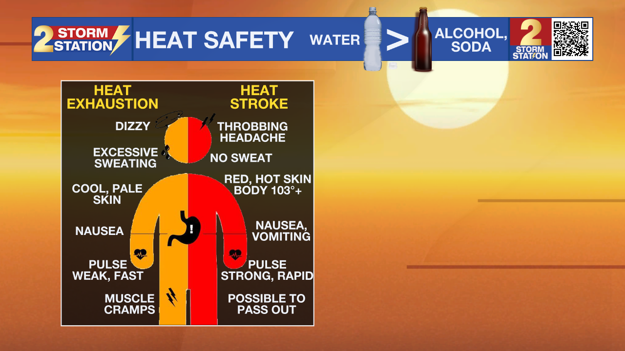
Today & Tonight: Thursday brings more of the same intense heat, so don't count on much relief. Afternoon temperatures will top out in the upper 90s, though humidity will drive feels-like values up near 108°. While a brief storm could pop up late in the day, the vast majority of the area will remain completely dry. If you happen to see one of these storms, expect a quick burst of heavy rain, strong winds, and relief from the intense heat. Any lingering rain fades after dark, leading to a warm night with lows staying in the upper 70s.

Up Next: Sticky, muggy starts in the mid to upper 70s will quickly give way to scorching afternoons near 100° in the coming days. Expect more heat alerts to be issued as this hot weather pattern continues. This level of unrelenting heat puts serious stress on AC units and leaves homes without air conditioning with little opportunity to cool down.
Friday will offer a better chance of showers and storms as atmospheric moisture increases. Unlike the typical summer pattern, these storms could last into the overnight hours as well. Confidence is still low in the exact placement and coverage of these storms. Current coverage is set at 40%, but that could increase as confidence improves over the next day or so. Just be advised that rain could be around if you have Friday evening plans.
A drier airmass moves in over the weekend, scaling back rain prospects. However, the upper 90s are not going anywhere through next week, leaving us with only the off chance of a spotty to isolated afternoon storm.
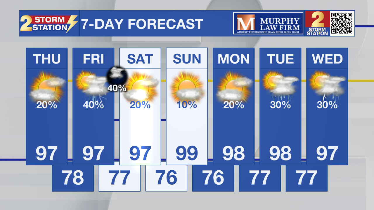
Get the latest 7-day forecast and real-time weather updates HERE.
Watch live news HERE.
The Tropics: No tropical development is expected over the next seven days across the North Atlantic, Gulf, and Caribbean.
— Balin
The Storm Station is here for you, on every platform. Your weather updates can be found on News 2, wbrz.com, and the WBRZ WX App on your Apple or Android device. Follow WBRZ Weather on Facebook and X for even more weather updates while you are on the go.
News

