Monday Midday Video Forecast
Related Story
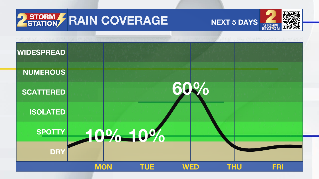
After collecting nearly an inch or more of rainfall around the Capital Area over the weekend, Veteran's Day will kickoff the new workweek with much drier conditions. Our next rainmaker is set to arrive by midweek.
Today & Tonight: Veteran's Day starts off with temperatures in the upper-60s and possible a patchy area of fog or two on the morning commute. Any clouds early in the day will break up, leading to partly sunny skies Monday afternoon. Highs will warm into the low and mid 80s around the state with a sticky feel remaining in place. While we cannot completely rule out a a spotty shower or two, especially southeast of Baton Rouge, rain coverage will be much lower than over the weekend. Tonight, temperatures will fall into the low 60s behind a weak front that will give a quick break from humidity.

Up Next: Tuesday will see a mix of sun and clouds and a high near 82° in the Capital Area. The relief from humidity does not last long, moisture will return to the region in ample amounts overnight Tuesday. As this happens, a front moving in from the west will allow more rain to arrive. Wednesday will see scattered to numerous showers and thunderstorm activity, heavy downpours and stronger storms are not out of the question. Even when not raining, Wednesday will be a bit of a dreary day with plenty of cloud cover. By Thursday, a cold front will push through the region ending rain chances from west to east during the morning hours. A cooler and less humid air mass might also trail said front. The latest Storm Station forecast calls for highs in the upper-70s and lows in the upper-50s. While relatively cooler, even that is well above the averages for this time of year.
Get the latest 7-day forecast and real time weather updates HERE.
Watch live news HERE.
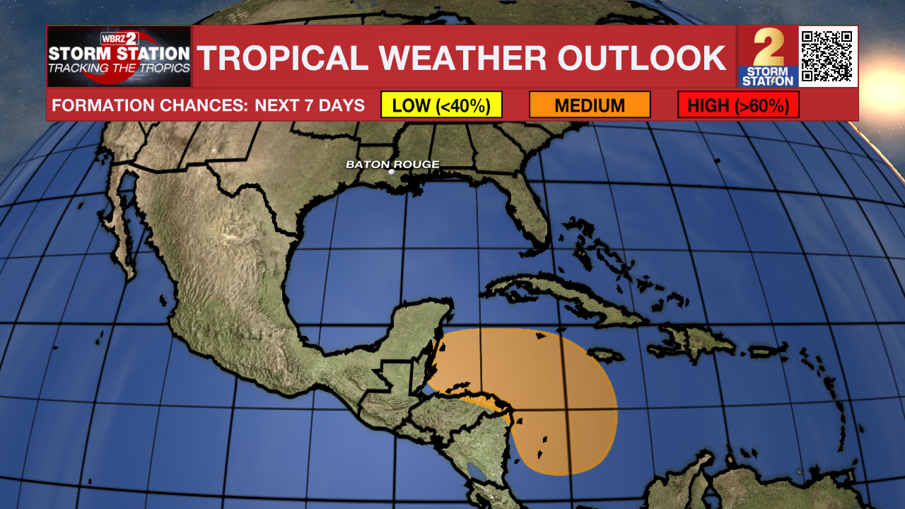
The Tropics: Rafael became post-tropical on Sunday afternoon. There are now no active tropical systems in the Atlantic Basin.

Meanwhile, a broad area of low pressure is expected to form over the western Caribbean Sea during the next couple of days. Environmental conditions appear conducive for some gradual development of this system thereafter, and a tropical depression could form late this week or this weekend while moving slowly westward.
-Emma Kate C.
The Storm Station is here for you, on every platform. Your weather updates can be found on News 2, wbrz.com, and the WBRZ WX App on your Apple or Android device. Follow WBRZ Weather on Facebook and Twitter for even more weather updates while you are on the go.


