

Latest Weather Blog
Wednesday PM Forecast: Beating the heat remains a daily challenge
The heat just won’t quit. Summer marches onward with lows in the mid-to-upper 70s and scorching highs in the upper 90s. Rain might provide occasional relief, but it doesn’t dominate the forecast.
Another Heat Advisory will be in effect area-wide from 11 a.m. to 8 p.m. Thursday as the heat index will top 108°+. The intense heat is now in week two, and the impact on the body accumulates over time. As this heatwave continues, consider checking in with friends and family — especially the elderly or anyone without access to A/C. Take frequent breaks in the shade, stay well-hydrated, and watch for signs of heat exhaustion.
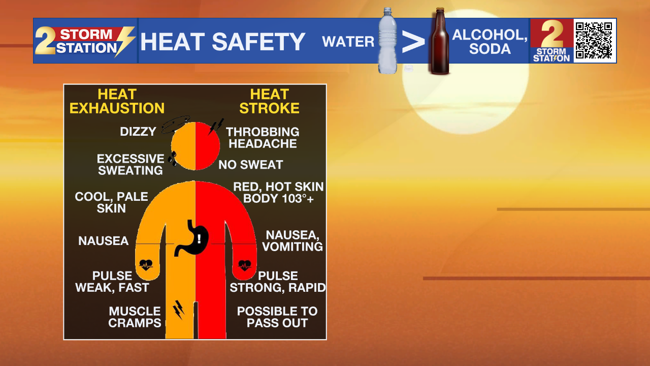
Tonight & Tomorrow: Daytime thunderstorms won’t last long into the evening. The rest of the night will bring clearing skies with temperatures dropping through the 80s, eventually slipping into the upper 70s by dawn. Don’t expect any major change on Thursday — it will still be hot. Look for a high in the mid-to-upper 90s, with a heat index running up to 108°. A spotty late-day thunderstorm cannot be ruled out, but most will stay dry. Those lucky enough to catch a downpour will face locally heavy rain, gusty winds, and a temporary cooldown.

Up Next: Humid mornings in the mid-to-upper 70s will transition to very hot afternoons in the upper 90s for the foreseeable future. Additional heat alerts are likely as the heat continues to stack up. Persistent heat will strain cooling systems and make recovery challenging, particularly for households without air conditioning.
A wave of moisture will arrive on Friday, boosting the rain coverage higher and raising the chance for a cooldown toward the commute home. Some storms might even linger into Friday night, though the exact timing is still unclear at this point. That will get ironed out over the next day or so. Drier air will gradually filter in over the weekend, lowering storm chances. The streak of upper-90s highs will continue next week, with nothing more than a spotty or isolated late-day shower or thunderstorm expected.
Trending News
Get the latest 7-day forecast and real-time weather updates HERE.
Watch live news HERE.
The Tropics: No tropical development is expected over the next seven days across the North Atlantic, Gulf, and Caribbean.
— Meteorologist Malcolm Byron
The Storm Station is here for you, on every platform. Your weather updates can be found on News 2, wbrz.com, and the WBRZ WX App on your Apple or Android device. Follow WBRZ Weather on Facebook and X for even more weather updates while you are on the go.
More News

