

Latest Weather Blog
Wednesday PM Forecast: Arctic chill settling in, a hard freeze potential for some
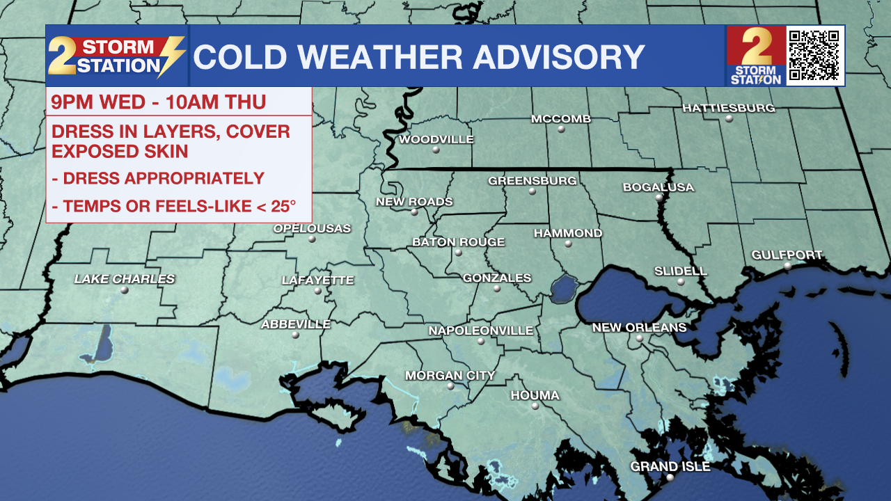
Another Arctic chill is settling in. A Cold Weather Advisory will be in effect from 9 p.m. Wednesday to 10 a.m. Thursday for the entire area. Northerly winds at 10-15 mph with overnight lows in the 20s will result in wind chills dipping into the teens. Frostbite and hypothermia will occur if uncovered skin is exposed to these temperatures for extended periods. Several layers will be needed when leaving for work or school. Some areas will be facing hard freeze conditions as well. The bitter cold will stick around through the remainder of the workweek.
As a reminder, starting this season, NWS has changed the cold weather alerts. You will receive different messages to highlight impacts than during previous winters. Review those changes, including the removal of Hard Freeze Warnings, HERE.
Tonight and Tomorrow: Stubborn clouds will break on Wednesday night. Clearing skies will help temperatures plummet overnight. Subfreezing conditions are likely for up to 16 hours, with most seeing a low in the 20s. Areas near and north of the interstate will see lows close to or under 25°. The freeze duration and frigid temperatures will be sufficient for a hard, or pipe, freeze in these areas. Proper precautions must be taken to avoid freezing or bursting pipes. And with a healthy north breeze, expect wind chills to drop into the teens. Some locations near the state line might see feels-like temperatures as low as 10°. Skies will quickly become sunny on Thursday, but it won’t do much to help temperatures. Look for a high in the mid-40s with daytime wind chills in the 30s.
Up Next: Another hard freeze is on the table along and north of I-10/12 on Friday morning. As air temperatures fall into the mid-20s again, expect a repeat of wake-up wind chills in the teens and 20s. Another Cold Weather Advisory will be in effect from 9 p.m. Thursday to 10 a.m. Friday to account for this. A partly sunny sky on Friday will help temperatures brush 50°. There will be less of a wind chill factor by then, but it will still be chilly.
Trending News
Weekend & Beyond: Saturday is trending toward a drier direction. But by Saturday night, another weak system could bring some light showers to the region. Scattered showers now appear to be a possibility on Sunday; however, a washout is not expected. Next week, the Arctic chill will be traded in for warmer weather as highs return to the 70s.
Get the latest 7-day forecast and real-time weather updates HERE.
Watch live news HERE.
-- Meteorologist Malcolm Byron
The Storm Station is here for you, on every platform. Your weather updates can be found on News 2, wbrz.com, and the WBRZ WX App on your Apple or Android device. Follow WBRZ Weather on Facebook and X for even more weather updates while you are on the go.
More News
