

Latest Weather Blog
Wednesday AM Forecast: Relief from heat is right around the corner
While Wednesday and Thursday will likely be the warmest and stickiest days of the week, a cool down and short-lived relief from humidity is just around the corner. As a cold front delivers the nicer weather, it's passage also brings a slight opportunity for severe weather.
Today & Tonight: "Feels-like" temperatures around the state early Wednesday clearly demonstrate how humid the air is this week. Temperatures reading in the upper-70's early Wednesday will actually feel like the mid-80s in the Capital Area. The temperatures will climb into the low-90s this afternoon with heat index values nearing 100°. Winds out of the south between 10-20mph will add a breeze to the very warm conditions, but also continue to pump in gulf moisture. Sky cover today will consist of a mix of sun and clouds, with mostly cloudy conditions taking over overnight. Thursday will start off with mainly cloudy skies and temperatures in the upper 70's.
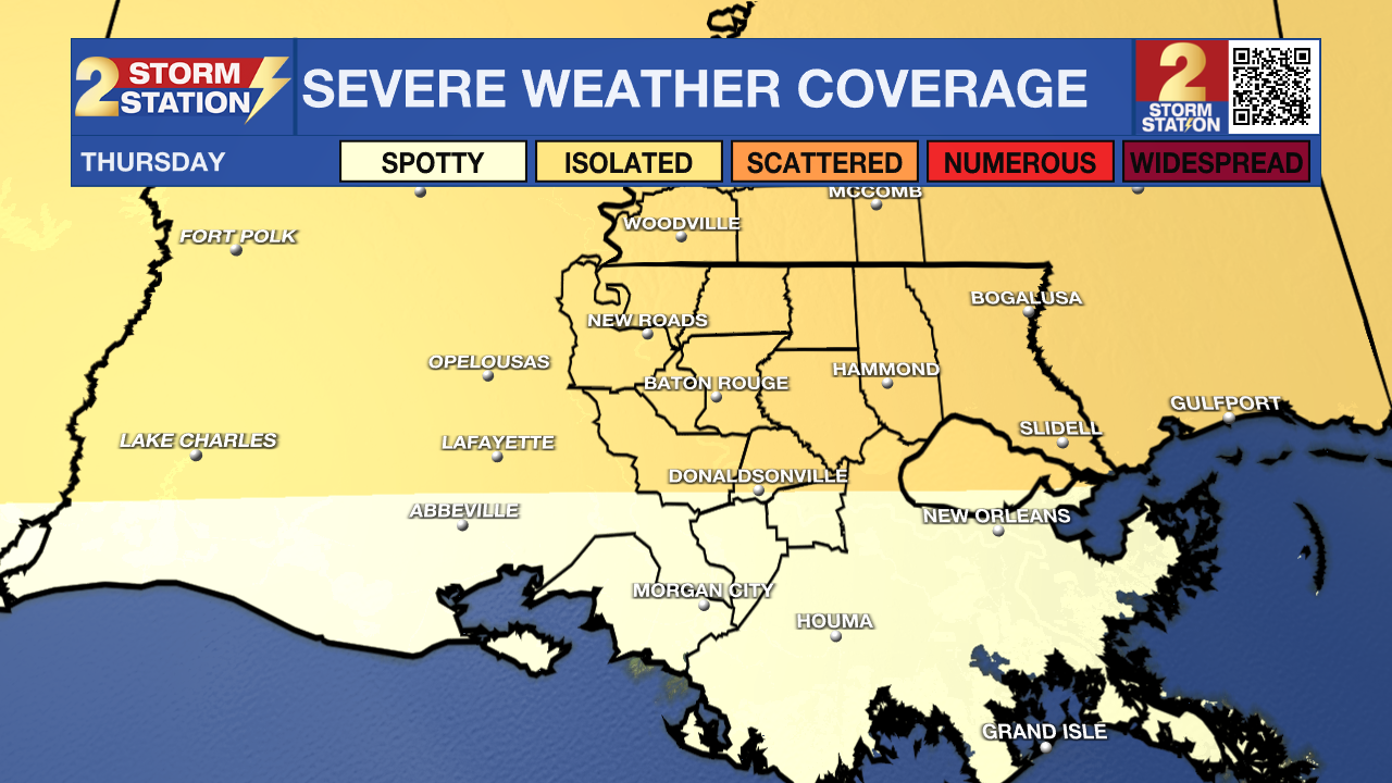
Up Next: Thursday will be the final day of the extremely warm and humid conditions for the week. Humidity levels will peak Thursday afternoon allowing temperatures in the low-90s to feel more like 100° at times. The heat is put to a halt when a strong cold front delivers a cooler and drier air mass to the state overnight Thursday. As the front moves through the state late Thursday night, isolated storms are expected to develop, some that could become strong to even warrant a severe warning. The biggest threat with this line of storms will be strong damaging winds and a low-end hail threat. While this mainly looks like an overnight event, it is important that you have a way to receive weather alerts while sleeping.
By Friday morning, any storms that develop should be off to the east and winds out of the north will begin to usher in drier and cooler air. Temperatures all weekend will be around average for this time of year with morning lows in the low-60s and afternoons in the low-80s. Humidity levels will be quite comfortable Friday and Saturday but will begin to increase again by late Sunday.
Trending News
As the former cold front stalls off the coast over the weekend, it will begin to move back north on Sunday, as a newly turned warm front. As the front slides closer to the state, moisture returns and the chance for scattered showers and storms also returns. Mother's Day does not look to be a washout, but give caution when planning events outdoors, some thunderstorms could develop during the day. The unsettled pattern of scattered showers will continue into the new workweek which will keep afternoon highs in the low-80s. As we get closer to the weekend, we will have a better idea of timing of Sunday's rain.
Get the latest 7-day forecast and real time weather updates HERE.
Watch live news HERE.
– Emma Kate Cowan
The Storm Station is here for you, on every platform. Your weather updates can be found on News 2, wbrz.com, and the WBRZ WX App on your Apple or Android device. Follow WBRZ Weather on Facebook and Twitter for even more weather updates while you are on the go.
More News
