

Latest Weather Blog
Wednesday AM Forecast: Heat and storms on the 4th, Jamaica seeing impacts from Beryl
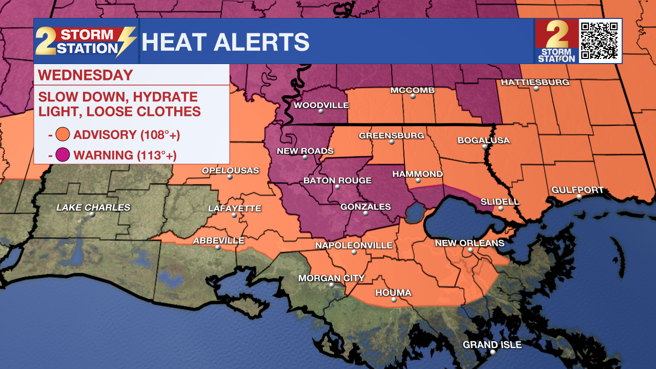
Though temperatures will not hit triple digits again Wednesday, heat and humidity still remains and so do the heat alerts. For the 4th consecutive day, an Excessive Heat Advisory has been issued for the Capital Area as we lead up to the Fourth of July holiday.
Today & Tonight: A bit more cloud cover and increased coverage of rain showers during the day will result in slightly lower temperatures Wednesday afternoon. High's on Wednesday are likely to reach into the mid-90's with heat index values close to 113°. While not as extreme of heat as we saw in previous days, these very warm values still call for an Excessive Heat Advisory for the Capital Area on Wednesday. Continue to practice heat safety; including staying extra hydrated and prioritizing breaks when spending extended periods outdoors. As a push of moisture moves into the region, around 50% of the area will see scattered showers and storms today, which will help cool off some areas temporarily.
Tonight, partly cloudy and mostly dry conditions return. Temperatures early Thursday morning will be in the upper-70's with the same sticky feel to the air.
Up Next: The July 4th holiday is shaping up to be a standard summer day. Look for a high temperature in the mid to upper-90s with lots of humidity and scattered thunderstorms. None have been issued yet, but another round of heat alerts is on the table. If you’re planning to watch the Fireworks on the Mississippi on the night of the 4th, the weather should cooperate. Storms will be coming to an end and temperatures will sit in the mid-80s. More of the same is expected into the weekend.

Trending News
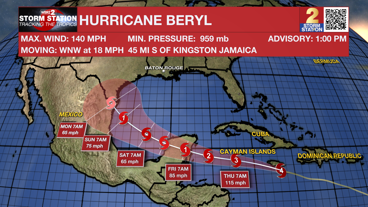
The Tropics: Beryl continues to gradually weaken. Although the system maintained Category 4 status as of the 1 p.m. Wednesday update, maximum sustained winds have dropped to 140 mph. Hurricane-force winds will move over Jamaica on Wednesday afternoon. In addition, life-threatening storm surge and heavy rainfall are likely in the region. The storm will then continue west through the Caribbean, brushing the Cayman Islands. Another landfall will occur in the Yucatan Peninsula on Thursday night. Beryl will then emerge over the southwest Gulf of Mexico this weekend. The storm might briefly regain hurricane status before making landfall along the western Gulf of Mexico. The latest data indicate a low chance of direct impacts for Louisiana. However, those along the Mexico and Texas coasts have a higher chance of seeing impacts and should monitor the system closely. Regardless, the Storm Station is continuing to keep a watchful eye on the storm.
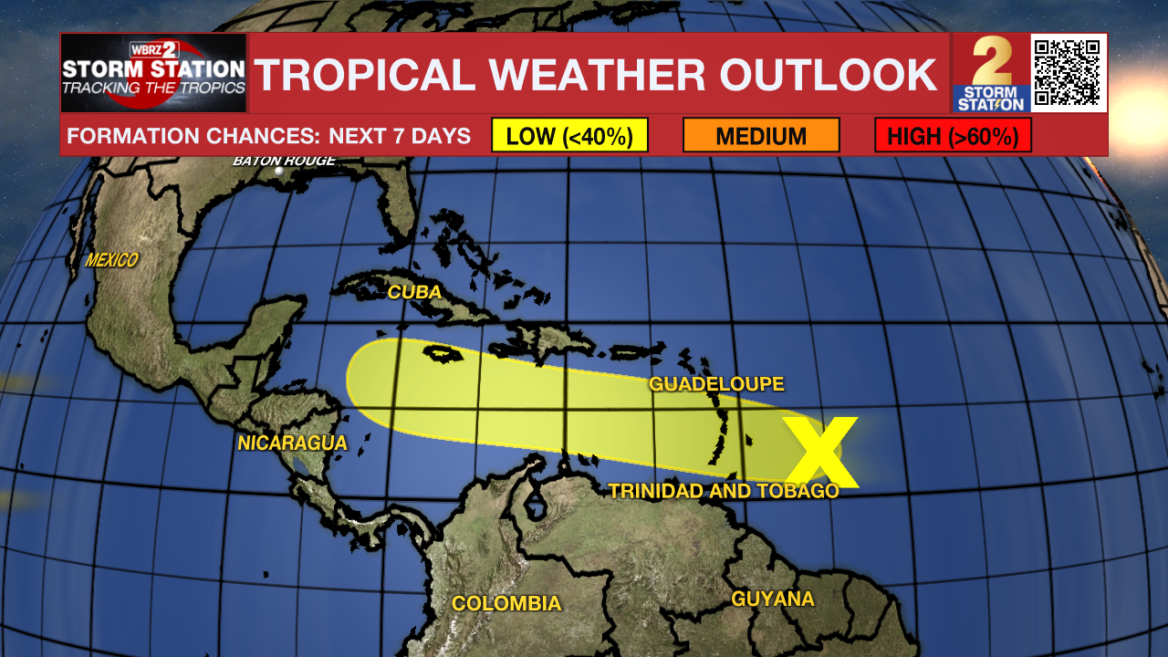
Another tropical wave trailing behind Hurricane Beryl is located east of the Lesser Antilles. The thunderstorms associated with this wave continue to become less organized. Tropical development now appears unlikely with this disturbance. Regardless, heavy rain and gusty winds are possible in the Lesser Antilles in the coming days, even in some areas already affected by Beryl.
Get the latest 7-day forecast and real time weather updates HERE.
Watch live news HERE.
- Emma Kate Cowan
The Storm Station is here for you, on every platform. Your weather updates can be found on News 2, wbrz.com, and the WBRZ WX App on your Apple or Android device. Follow WBRZ Weather on Facebook and Twitter for even more weather updates while you are on the go.
More News
