

Latest Weather Blog
Thursday PM Forecast: several more hours below freezing with upper teens wind chills
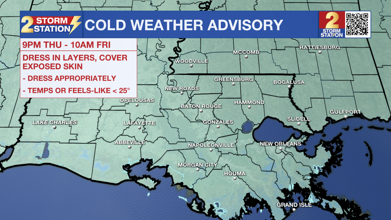
Another Cold Weather Advisory will be in effect from 9 p.m. Thursday to 10 a.m. Friday for the entire Capital Area. Although winds will lessen overnight, a northeasterly wind at 5-10 mph will be enough to drop wind chills into the upper teens by sunrise on Friday. Wear several layers and cover extremities to protect against frostbite and hypothermia, especially when traveling to work or school. Hard freeze conditions will be a possibility for another night as well.
As a reminder, starting this season, NWS has changed the cold weather alerts. You will receive different messages to highlight impacts than during previous winters. Review those changes, including the removal of Hard Freeze Warnings, HERE.
Tonight & Tomorrow: A mainly clear sky will result in a fast temperature drop during the evening. Lows will fall into the middle-20s for the second night in a row. Expect another lengthy freeze on the order of 12 hours, with several below 28° near and north of I-10/12. That would be sufficient for a pipe freeze. All 4 P’s – people, pets, plants, and pipes - must be protected again in these areas. Even areas closer to the coast might want to consider protecting pipes as a precaution since hard freeze conditions will not be far away. A mixture of sun and high clouds will push temperatures above freezing by mid-morning. Look for a high near 50° by peak heating. Clouds will increase late in the day, but rain will not be a concern.
The Weekend: A weak weather disturbance will move across the southern part of the country. After starting with lows in the upper 30s, expect more clouds to be around on Saturday which will keep highs cool and in the 50s. The atmosphere will stay dry enough to hold off rain through much of Saturday which is good news for local parades. Southwest winds will help bring in more moisture later Saturday night. Especially after midnight, scattered showers and possibly even a steady period of rain can be expected well into Sunday. Total rain amounts look like they will be on the lower end with less than half an inch for most locations. The clouds and rain should keep Sunday quite chilly with highs struggling to get beyond the low 50s.
Trending News
Next Week: A general warming trend is expected due to high pressure in the mid-levels of the atmosphere. Another cold front is expected by Wednesday night or Thursday morning, but it doesn’t look like it will bring a big punch of chilly air.
Get the latest 7-day forecast and real-time weather updates HERE.
Watch live news HERE.
The Storm Station is here for you, on every platform. Your weather updates can be found on News 2, wbrz.com, and the WBRZ WX App on your Apple or Android device. Follow WBRZ Weather on Facebook and X for even more weather updates while you are on the go.
More News
