Thursday PM Forecast: no treat, just a trick from first rain in more than a month
Dreary weather has overtaken the Capital Area for the first time in nearly a month. Including trick-or-treating on Halloween night, showers will remain in play for outdoor activities until the weekend.
Tonight & Tomorrow: Unfortunately, the first rain in quite some time arrived as many looked to get outside and celebrate All Hallow’s Eve. Expect showers to continue into the night with occasional thunder and lightning. Please take a break to safety inside if lightning is detected nearby. You can use the Storm Station Weather App to get notifications about rain and lightning. Beyond midnight, showers will taper with remaining clouds keeping temperatures in the low 70s. Friday will be cloudy with scattered showers and a few thunderstorms. Again, an all-day washout is not anticipated but many locations will pick up some rain. The gloomy conditions will keep high temperatures in the low 80s. While rain will be on a downward trend into the evening, a poncho might be wanted for high school football.

Up Next: The weekend is looking primarily dry, warm and unseasonably humid with highs in the upper 80s and lows in the upper 60s. Skies will feature a mix of sun and clouds. Not much change is expected for the new workweek and first full week of November. A number of record highs, and especially record warm lows will be in danger with highs near 90 and lows near 70. Partly sunny skies may yield a spotty shower with daytime warming, mainly later in the week. By next Thursday or Friday, a wind shift may bring in some drier, less humid air.
Trending News
Get the latest 7-day forecast and real time weather updates HERE.
Watch live news HERE.
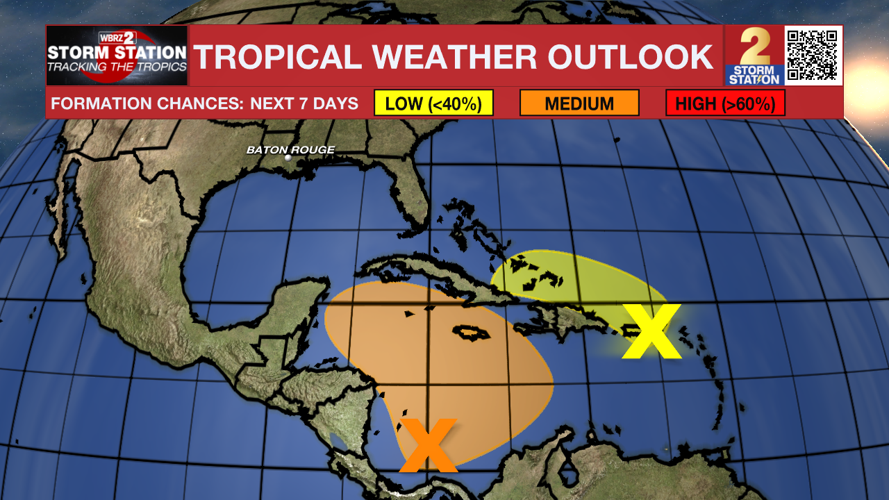
The Tropics: A broad area of low pressure is likely to develop over the southwestern Caribbean Sea during the next day or two. Gradual development is possible thereafter, and a tropical depression could form over the weekend or early next week while the system drifts generally northward or northwestward over the central or western Caribbean Sea.

A trough of low pressure near Puerto Rico is producing widespread cloudiness and showers over the Dominican Republic, Puerto Rico, the Virgin Islands, the northern Leeward Islands, and the adjacent waters of the Atlantic and the northeastern Caribbean. Slow development of this system is possible during the next 2-3 days as it moves west-northwestward near the Greater Antilles. After that time, this system is expected to be absorbed into the low pressure area over the Caribbean.
Showers and thunderstorms have developed near the center of a storm-force non-tropical low pressure area located about 550 miles west of the western Azores. However, any additional development into a subtropical or tropical cyclone is expected to be slow to occur as the system moves eastward during the next few days.
– Josh
The Storm Station is here for you, on every platform. Your weather updates can be found on News 2, wbrz.com, and the WBRZ WX App on your Apple or Android device. Follow WBRZ Weather on Facebook and Twitter for even more weather updates while you are on the go.


