

Latest Weather Blog
Sunday PM Forecast: temperatures to remain above average, disturbance could enter Gulf next week
More warm and dry conditions are set to persist for a majority of next week. A disturbance could enter the Gulf of Mexico later in the week (more in tropics section).
Tonight & Tomorrow: Lows will begin to tick up a bit tonight. Most will start off in the upper 60's under mostly clear skies. Monday will be a continuation of Sunday's weather. Highs will get into the lower 90's under partly sunny skies. It will feel a touch muggy, but feels like temperatures will only be a couple of degrees higher than the actual temperature. Once again, there is no chance of rain.
Up Next: Expect more of the same through the middle of the week. Highs will be in the lower 90's, lows near 70, and rain chances will stay near zero. Some changes will start to occur at the end of the week. This will be mainly due to moisture values increasing, driving up rain chances. Further adjustments will likely be needed for the exact rain coverage. Into next weekend, temperatures will be slightly above average, with slight chances of rain.
Get the latest 7-day forecast and real time weather updates HERE.
Watch live news HERE
Trending News
The Tropics:
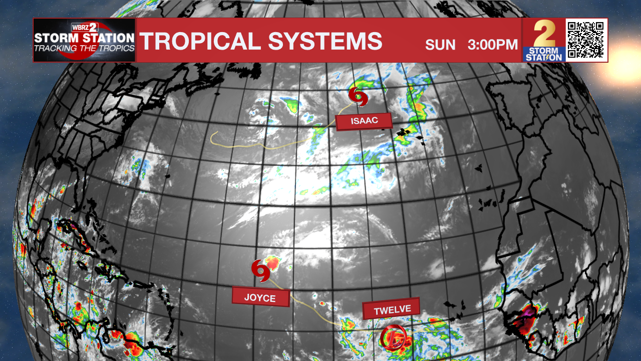
Tropical Depression Twelve has recently formed in the Eastern Atlantic. It has winds of 35 mph and is moving west at 9 mph. Twelve will likely acquire the name of Kirk in the next 24 hours. It is then expected to strengthen into a Hurricane by Wednesday. Future Kirk will stay over the open waters of the Atlantic the next 7 days.
Tropical Storm Joyce is gradually weakening. It has maximum sustained winds of 40 mph, and is moving NW at 6 mph. Joyce will become post-tropical on Monday.
Hurricane Isaac is continuing to wind down. It is now a category 1 hurricane with 70 mph winds, and is moving NE at 12 mph. Isaac is moving into cooler waters, which will lead to gradual weakening and likely will become post tropical on Monday.
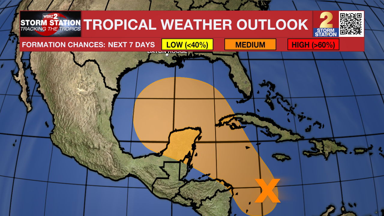
A broad area of low pressure located over the western Caribbean Sea is producing disorganized showers and thunderstorms. Environmental conditions appear to be conducive for gradual development, and a tropical depression could form around the middle part of this week while the disturbance meanders towards the west-northwest. This system is then expected to move northwestward into the Gulf of Mexico during the latter portion of this week, and interests in the
northwestern Caribbean Sea and along the U.S. Gulf Coast should monitor its progress.
A low-latitude tropical wave located near the coast of western Africa is currently producing limited shower and thunderstorm activity. Upper-level winds are forecast to become more conducive for gradual development of this system during the next several days while it moves slowly westward or west-northwestward over the eastern Atlantic Ocean.
– Balin
The Storm Station is here for you, on every platform. Your weather updates can be found on News 2, wbrz.com, and the WBRZ WX App on your Apple or Android device. Follow WBRZ Weather on Facebook and Twitter for even more weather updates while you are on the go.
More News
