

Latest Weather Blog
Sunday PM Forecast: Daytime downpours sticking around for now; tropics waking up
Sporadic daytime downpours will stick around to start the new week before tapering off, letting heat take center stage by the week’s end. Meanwhile, the tropics are starting to wake up.
Tonight & Tomorrow: Afternoon downpours will fade toward nightfall, making way for clearing skies and morning lows in the mid-70s. It will be humid for the morning commute. Expect early sunshine to push temperatures into the 90s by lunchtime, peaking in the low-to-mid 90s by afternoon. Scattered thunderstorms will build on the heat and humidity, covering roughly half the area. The rain won’t be long-lasting, but sporadic heavy downpours could create hazardous driving conditions, in addition to frequent lightning in affected areas. These storms will fizzle fast during the evening.
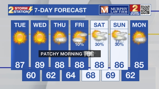
Up Next: The number of afternoon thunderstorms will diminish with each passing day for the rest of the workweek. With thinning cloud cover and fewer showers, heat will build across the Deep South. Highs in the mid-90s will become routine, with upper 90s possible by next weekend. High humidity may also prompt heat alerts later in the week.

Trending News
Get the latest 7-day forecast and real-time weather updates HERE.
Watch live news HERE.
The Tropics: As August continues and the peak of hurricane season approaches, there are a few tropical waves in the Atlantic worth monitoring.

Eastern & Central Tropical Atlantic — A small area of low pressure has formed a few hundred miles south of the Cabo Verde Islands. This system will slowly move westward and merge with a tropical wave in the coming days. Conditions are projected to be conducive for gradual development thereafter. A tropical depression may form for the latter half of this week while the system moves west-northwestward across the tropical Atlantic. There is a 50% chance of tropical development at this time.
Central Tropical Atlantic — A broad area of thunderstorms associated with a tropical wave is located midway between the west coast of Africa and the Lesser Antilles. Gradual development of this system is possible for the first half of the upcoming week; however, the wave will eventually encounter a more hostile environment by late week as it approaches the Lesser Antilles. Overall development odds are placed at 20% for now.
Western Subtropical Atlantic — A region of low pressure located a few hundred miles west-northwest of Bermuda is disorganized as of Sunday evening. Some development of this system is possible over the next couple of days as it continues easterward through the subtropical Atlantic. The system is forecast to reach cooler waters by late week, ending its chances of formation after Wednesday. Even so, development odds are placed at 10% beforehand.
— Meteorologist Malcolm Byron
The Storm Station is here for you, on every platform. Your weather updates can be found on News 2, wbrz.com, and the WBRZ WX App on your Apple or Android device. Follow WBRZ Weather on Facebook and X for even more weather updates while you are on the go.
More News

