Sunday PM Forecast: A drier Veteran's Day, tracking a pair of fronts and moisture surge afterward
Veteran's Day looks to be drier after the latest soggy stretch. Thereafter, the Storm Station will be tracking a pair of fronts and a surge of moisture. Each will result in many day-to-day variations.
Tonight & Tomorrow: Although a spotty shower is not completely out of the question on Sunday evening, much of the night will be dry. Partial clearing will take place. If skies clear out and winds relax to sufficient levels, some spots could see some patchy fog and/or low cloud development closer to sunrise. Overnight lows will be incredibly mild, yet again. Look for a wake-up temperature in the upper-60s to near 70°. Veteran's Day will feature clearing skies with a high in the mid-80s. Rain will be tough to find, although there is a slim chance to come across a stray sprinkle primarily to the southeast of Metro Baton Rouge.
Up Next: A weak front will slide through the region on Monday evening. That will result in a brief humidity break, which in turn will produce in a relatively cooler start on Tuesday. But emphasis must be placed on the brief nature of this humidity break. It comes back Tuesday night. The moisture surge in addition to an approaching upper-level disturbance will result in another round of scattered showers and thunderstorms on Wednesday. Out of all features this week, the moisture surge will be the most inconvenient due to the rain - that is the Capital Area's next impact. By Thursday, a cold front will push through the region ending rain chances from west to east. A cooler and less humid air mass might also trail said front. The latest Storm Station forecast calls for highs in the upper-70s and lows in the upper-50s. While relatively cooler, even that is above the averages for this time of year.
Get the latest 7-day forecast and real time weather updates HERE.
Watch live news HERE.
Trending News
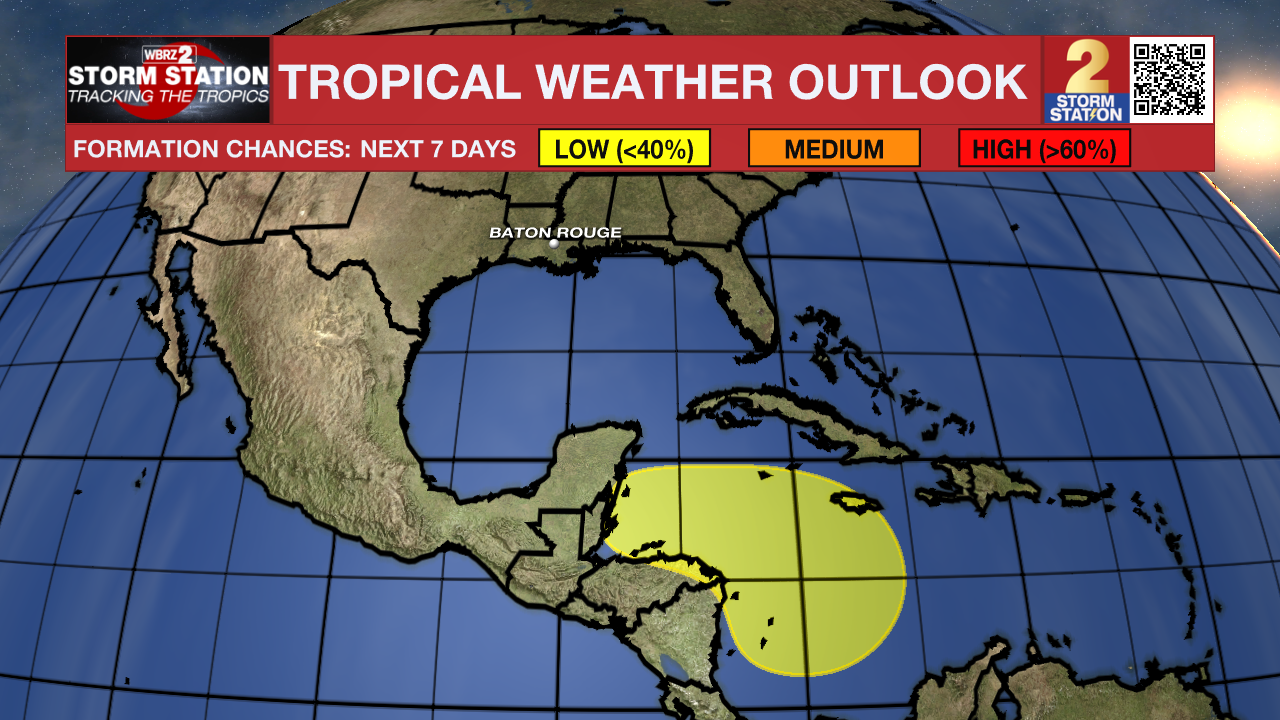
The Tropics: Rafael became post-tropical on Sunday afternoon. There are now no active tropical systems in the Atlantic Basin.
Meanwhile, a broad area of low pressure will likely form over the southwestern Caribbean Sea in a few days. Some slow development is possible after that time while the system drifts westward. For now, this area of interest only has low odds of tropical development.

-- Meteorologist Malcolm Byron
The Storm Station is here for you, on every platform. Your weather updates can be found on News 2, wbrz.com, and the WBRZ WX App on your Apple or Android device. Follow WBRZ Weather on Facebook and Twitter for even more weather updates while you are on the go.


