

Latest Weather Blog
Monday PM Forecast: rainmaker followed by big chill
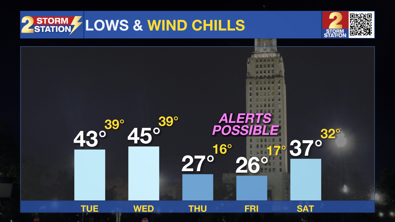
There are two weather impacts to monitor this week. First, a storm system is expected to bring an inch or two of rain and possibly even some hail on Tuesday night. Second, a big temperature drop will follow that system with low wind chills hard freeze conditions for some areas on Thursday and Friday morning.
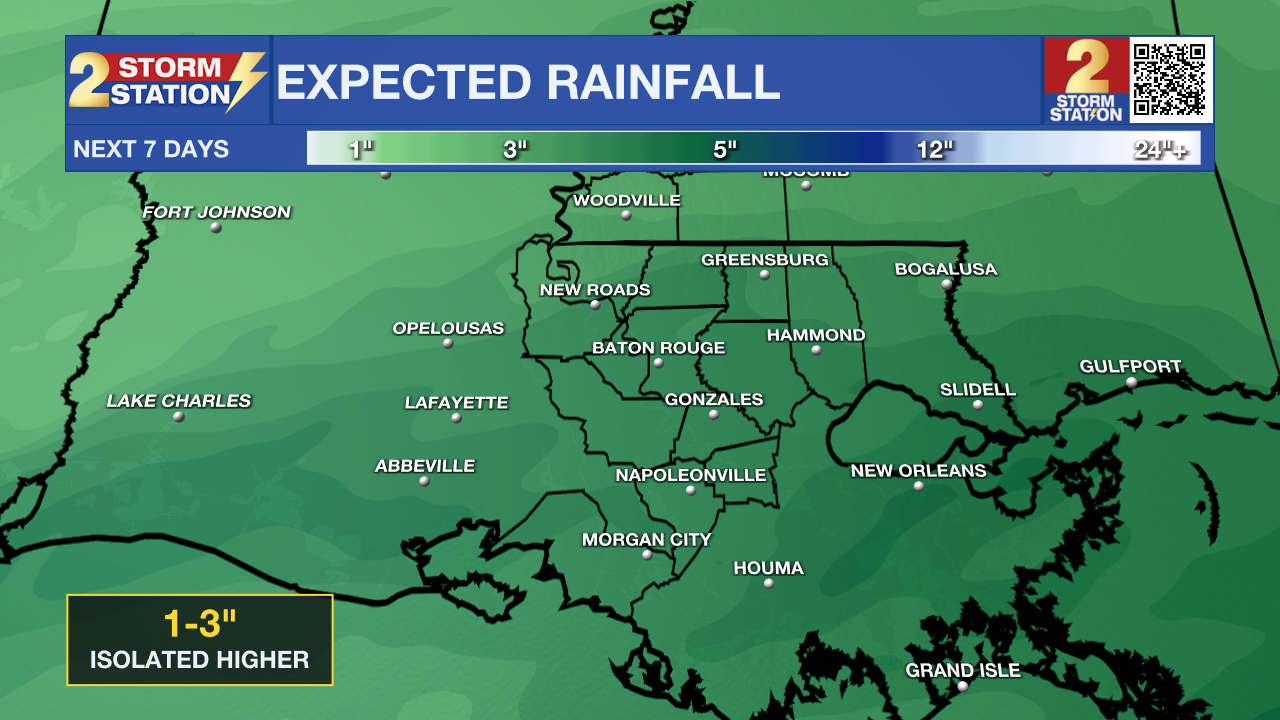
Tonight and Tomorrow: Expect another mostly clear night with light winds shifting eastward. It won’t be as cold as last night with lows in the low 40s. Clouds will start rolling in on Tuesday stalling highs in the upper 50s and low 60s. By the evening, light rain could begin near sunset. A developing system near the Louisiana coast will push more moisture into the area, increasing the chances of steady rain through Tuesday night. Some thunderstorms are possible with this system. Most severe weather should stay offshore, but if any can migrate inland, hail would be the most likely hazard. Expect widespread rainfall totals of 1-2 inches, with an isolated total near 3 inches. While flooding isn’t a major concern, heavy rain in urban areas could lead to some localized runoff issues.
Up Next: As the storm system moves east Wednesday morning, rain will come to an end, but a shot of Arctic air will follow. Temperatures likely won’t budge much throughout the day, especially if clouds stick around, which looks increasingly likely. In fact, the dates high may occur before we wake up! Get ready for some seriously cold mornings. Most areas will drop below freezing Thursday morning, with even colder conditions expected Friday morning. Areas north of I-12 could see a hard freeze, which means temperatures dipping low enough to damage plants and pipes. While this won’t be as brutal as January’s deep freeze, it’ll still be a shock—especially since some plants were already waking up during the recent warm stretch. On both mornings, wind chills could also drop into the teens and 20s, making it feel even colder. Expect Cold Weather Advisories to be issued soon.
Trending News
Weekend Outlook: By Saturday, another weak system could bring some light rain in the afternoon or evening. The good news is that temperatures will have warmed up enough that we don’t need to worry about ice or snow. The bad news is that we’re moving into the heart of parade season and might need to think about taking some umbrellas or ponchos this weekend.
Get the latest 7-day forecast and real-time weather updates HERE.
Watch live news HERE.
– Josh
The Storm Station is here for you, on every platform. Your weather updates can be found on News 2, wbrz.com, and the WBRZ WX App on your Apple or Android device. Follow WBRZ Weather on Facebook and X for even more weather updates while you are on the go.
More News
