

Latest Weather Blog
Monday PM Forecast: Gorgeous weather to continue; an untimely arrival of the next impact
After a sunny start, the week will end on a warmer note with increasing clouds. That will signal the arrival of the next impact by the weekend—storms.
Tonight & Tomorrow: Clear skies and relaxing winds will lead to a chilly night in the Capital Region. Expect a wake-up temperature in the low to mid-40s. Despite a morning chill, the afternoon will be quite pleasant. Look for a high in the mid to upper-70s under a sunny sky.
Up Next: The return of southerly winds on Wednesday will allow temperatures to climb higher through the rest of the workweek. By Thursday and Friday, expect highs to return to the middle-80s. A minor disturbance will bring nothing more than a spotty shower or two late Wednesday into Thursday. However, a more potent storm system will take shape closer to the weekend—that will be the next impact.
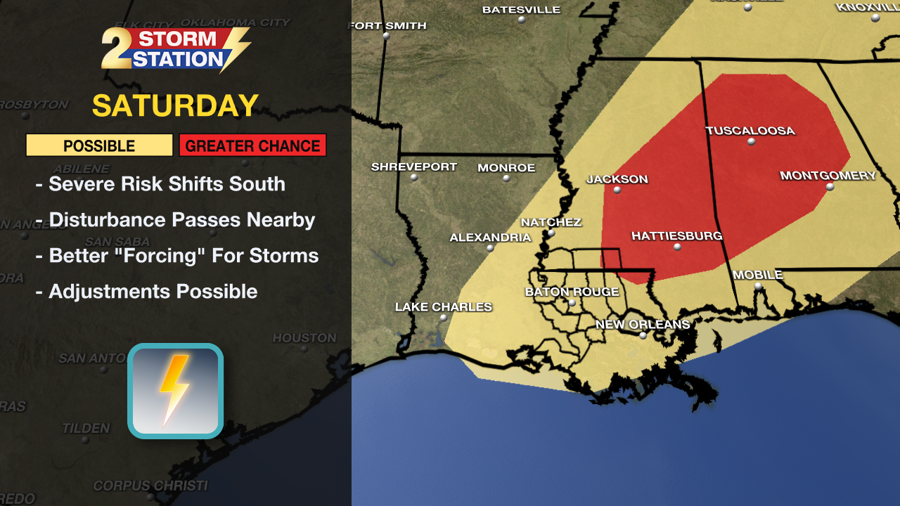
The Capital Area will be dodging spotty storms on Friday, but rain chances climb even higher on Saturday. Numerous showers and storms are likely by then, and a few storms could be on the strong to severe side. While the large-scale pattern looks supportive of stronger storms, the smaller scale features at play won’t be known until later in the week. Many times, it is these smaller features that determine the timing and severity of an event. Stay in touch with the Storm Station through the week as the forecast becomes more refined. The second half of the weekend will fare off a lot nicer with sunshine returning.
Trending News
Get the latest 7-day forecast and real-time weather updates HERE.
Watch live news HERE.
-- Meteorologist Malcolm Byron
The Storm Station is here for you, on every platform. Your weather updates can be found on News 2, wbrz.com, and the WBRZ WX App on your Apple or Android device. Follow WBRZ Weather on Facebook and X for even more weather updates while you are on the go.
More News
