

Latest Weather Blog
Monday AM forecast: Flood Watch continues for much of the Capital Region
Slow-moving storms on Monday could dump another 1 to 3 inches of rain per hour, leading to localized flash flooding and water-covered roads. The heaviest rain will stay south of the interstates.

Today and tonight: Rounds of showers and thunderstorms will continue across Baton Rouge and surrounding communities Monday as a very wet weather pattern remains locked in across south Louisiana. A Flood Watch remains in effect through Monday evening for a large part of the Capital Region, and additional storms are expected to develop through the afternoon and evening hours. Some storms will be capable of producing torrential rainfall in a short amount of time, especially in areas that have already picked up heavy rain over the past several days.

Use the slider to advance through the next 24 hours of Futurecast
Trending News
Temperatures will stay slightly below average for late May because of the clouds and rain, with highs mainly in the lower 80s. Humid conditions will continue overnight with scattered showers and storms lingering into late Monday night.
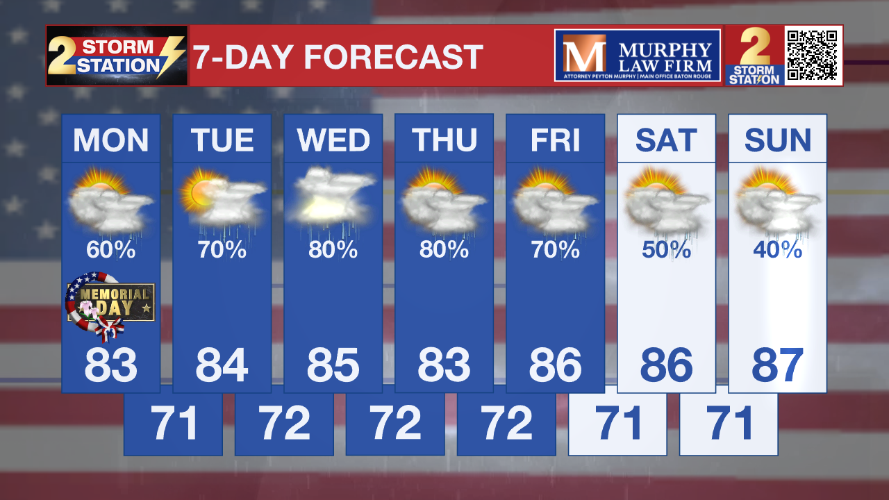
Up Next: The unsettled pattern is expected to continue through much of the upcoming week as additional disturbances move across the Gulf South. Daily rounds of showers and thunderstorms are expected Tuesday through at least Thursday, with more locally heavy rainfall possible each afternoon and evening. Flooding concerns may continue where storms repeatedly move over the same areas. Additional rises on rivers and streams are also possible later this week if rainfall totals continue to add up around the Capital Region.
What to look out for: Localized flash flooding remains the primary concern. Rainfall rates of 1 to 3 inches per hour could quickly overwhelm drainage systems and flood roads, especially in low-lying and poor drainage areas. A few storms may also produce gusty winds and dangerous lightning during the afternoon and evening hours.
Get the latest 7-day forecast and real-time weather updates HERE.
Watch live news HERE.
– Dave
The Storm Station is here for you, on every platform. Your weather updates can be found on News 2, wbrz.com, and the WBRZ WX App on your Apple or Android device. Follow WBRZ Weather on Facebook and X for even more weather updates while you are on the go.
More News

