

Latest Weather Blog
Friday AM Forecast: some could see rain today, eyeing first true fall cold front
There will be a brief uptick in rain chances today, but these showers and storms will remain isolated in nature. The Storm Station is tracking the first true fall cold front! Very pleasant conditions will arrive next week.
Today & Tonight: We are starting off the morning with a lot of cloud cover. A decent amount of these clouds will stick around throughout the day. Some rain will be possible as well, and about 40% of the viewing area will pick up measurable rainfall. If heading out to see some Friday night football, most shower activity will be wrapping up around 5-7 pm. Rain chances will be non-zero during the first half of some of these games, so a precautionary poncho is a good idea. Highs will get up into the upper 80's, with humidity making that feel closer to 100 degrees. Tonight, lows will get to near 73 degrees under mostly cloudy skies.
Up Next: The uptick in rain chances will be very brief, and the weekend will trend drier. Spotty showers will be possible Saturday and Sunday, with the best chances south of I-10. For Southern Football, clearing skies are expected by kickoff with a muggy temperature in the low 80s. Temperature wise, the weekend is looking unseasonably warm, with highs near 90 degrees.
On Monday, moisture will begin to decrease as we await the arrival of our first true fall cold front. The much anticipated front will push through in the evening hours, making the rest of the week much more pleasant outside. High temperatures will stay in the mid 80s for most of the week, with lows in the lower 60's. Some spots north of the city could reach the upper 50s for the first time this fall.
Get the latest 7-day forecast and real time weather updates HERE.
Trending News
Watch live news HERE.
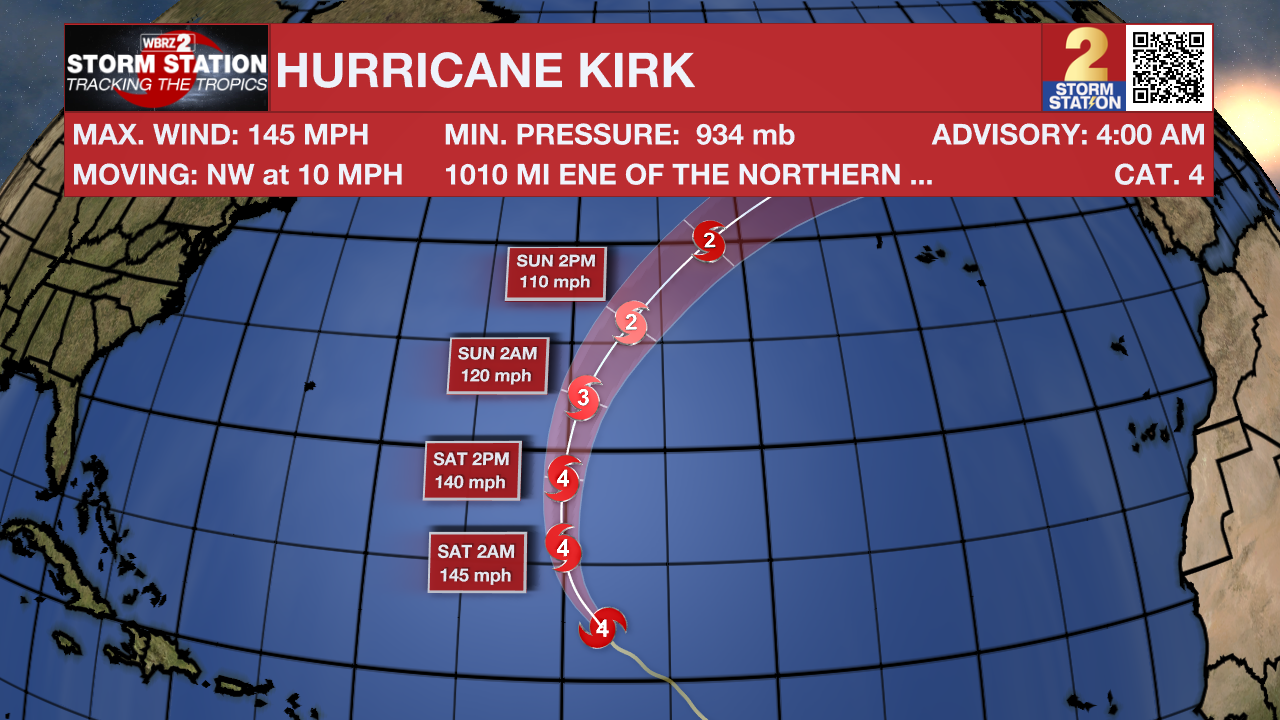
The Tropics: Hurricane Kirk is a major storm packing maximum sustained winds of 145mph over the central Atlantic Ocean. While no direct impacts to land are anticipated, some swells could reach the United States this weekend. Kirk may strengthen further while moving northwest over open water.
Following Kirk is Tropical Storm Leslie which is also gradually getting better organized. Maximum sustained winds of 60mph will intensify with a hurricane expected as the storm moves west and then northwest following Kirk out to sea.
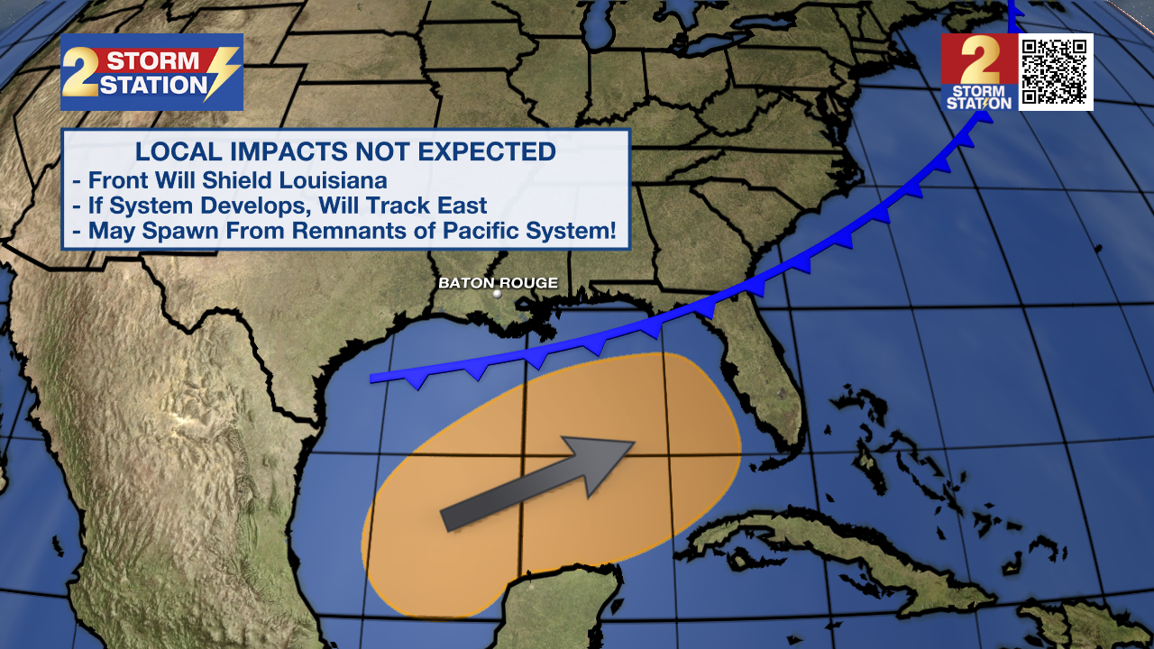
Disorganized showers and thunderstorms located over the western Gulf of Mexico are associated with a trough of low pressure. A broad area of low pressure is expected to form over the southwestern or south-central Gulf of Mexico this weekend, and thereafter some gradual development is possible while the low moves slowly eastward or northeastward. A tropical or subtropical depression or storm could form during the early to middle part of next week if the low remains separate from a frontal boundary that is forecast to extend across the Gulf of Mexico next week. Regardless of tropical or subtropical development, locally heavy rains could occur over portions of Mexico during the next few days and over portions of the Florida Peninsula late this weekend into next week.
– Balin
The Storm Station is here for you, on every platform. Your weather updates can be found on News 2, wbrz.com, and the WBRZ WX App on your Apple or Android device. Follow WBRZ Weather on Facebook and Twitter for even more weather updates while you are on the go.
More News
