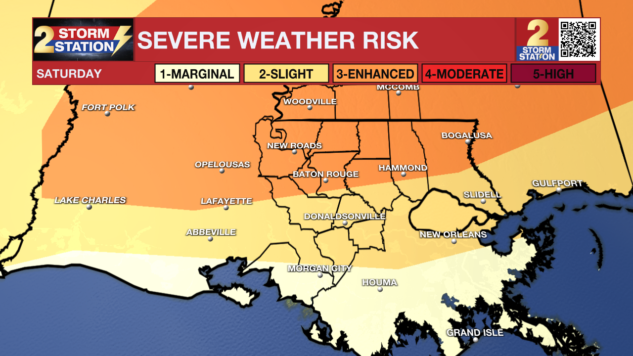
Dense fog tonight, severe threat on Saturday
Before the storms on Saturday, dense fog will be a possibility. Visibilities have a chance of dropping below one quarter of a mile. After the fog, the main headline becomes the threat of severe weather, including tornadoes.
Tonight & Tomorrow: Clouds will begin to build once again as we move into the overnight hours. These will be very low clouds, and will eventually reach the ground as fog. A ***Dense Fog Advisory*** has been issued for the entire Capital Area. This will go into effect from 6 PM this evening until 10 AM tomorrow morning. Lows will be in the middle 60s. Showers and some thunderstorms will start to increase in coverage in the morning hours. Expected isolated to scattered storms throughout the rest of the morning and into the afternoon. These do have the chance of becoming severe, but is an overall lower threat. The best chance of severe weather will be with a widespread line of storms in the evening. Isolated tornadoes, scattered damaging winds, and spotty instances of hail cannot be ruled out. Other than the storms, it will be a warm day with highs in the upper 70s.

Up Next: By early Sunday morning, a cold front will finally push through the state, ending the severe weather threat and bringing back dry and sunny conditions. No major temperature drop will follow this front. Another cold front will pass on Tuesday, and finally bring cooler temperatures for the start of 2025.
Trending News
Get the latest 7-day forecast and real time weather updates HERE.
Watch live news HERE.
– Balin
The Storm Station is here for you, on every platform. Your weather updates can be found on News 2, wbrz.com, and the WBRZ WX App on your Apple or Android device. Follow WBRZ Weather on Facebook and X for even more weather updates while you are on the go.


