

Latest Weather Blog
Wednesday Midday Video Forecast
Related Story
The final week of April will feature warm afternoons and very limited rain. Humidity and breezy winds make a return for the weekend.
Today & Tonight: Morning lows early Wednesday are a sign of the warming trend that's underway. We will begin the day with lows in the mid to upper 50s around the Capital Region. With mainly sunny conditions all day, temperatures will quickly warm into the mid-80s this afternoon. If you're planning to head out to celebrate the LSU Gymnastics team this evening, when the parade rolls, temperatures will still be in the low 80's only cooling into the 70s when the sun sets around 8:00pm. Winds will be light all day long out of the southeast.
Overnight tonight, mainly clear skies and calm winds will allow for temperatures to cool into the low 60s. We will see an increase in dew points over the next 24 hours which could result in patchy areas of fog early Thursday morning.
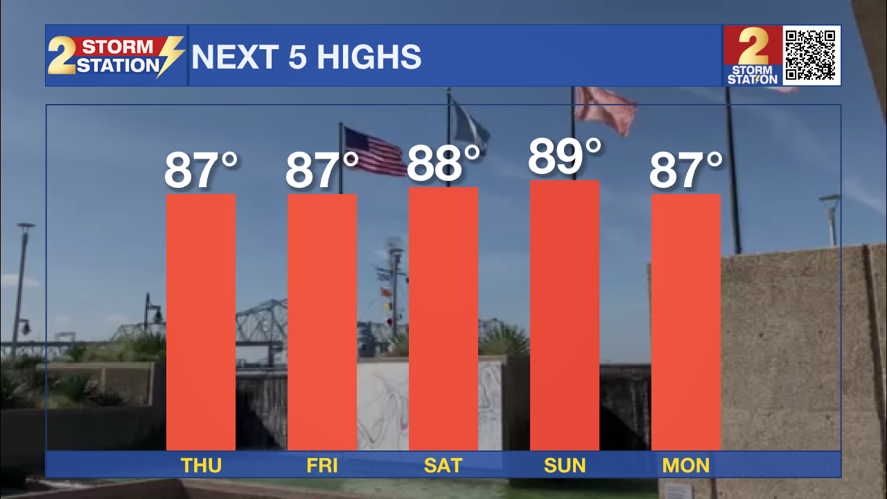
Up Next: Temperatures will be back in the upper 80's Thursday afternoon and will return there each day to conclude the month. Morning lows will also begin to warm each day, expect morning temperatures near 70° by the weekend. Along with the temperatures, humidity levels and cloud cover will gradually rise as we head towards the weekend. Friday will feature the most clouds of the week. Our next rain chance does not arrive until Monday, when only isolated storm activity is expected.
Get the latest 7-day forecast and real time weather updates HERE.
Watch live news HERE.
- Emma Kate Cowan
The Storm Station is here for you, on every platform. Your weather updates can be found on News 2, wbrz.com, and the WBRZ WX App on your Apple or Android device. Follow WBRZ Weather on Facebook and Twitter for even more weather updates while you are on the go.
News
