

Latest Weather Blog
Thursday morning video forecast
Related Story
Quiet and dry conditions continue this morning as the region remains under the influence of below-normal temperatures. It will be warmer today, although it won’t last. Another cold front is approaching later tonight. Attention is increasingly turning toward a much stronger Arctic blast this weekend.

Today and tonight: Today starts cold but calm, with mostly sunny skies. Temperatures may reach 60 in some areas. Winds stay light through the day, then turn northwesterly tonight as colder air begins filtering back in. Overnight lows will fall into the upper 30s.

Use the slider to advance through the next 24 hours of Futurecast
Up Next: Friday stays mostly dry but turns colder throughout the day as Arctic air begins to surge south late in the afternoon and evening. The cold intensifies Friday night and persists through the weekend, bringing temperatures similar to this past weekend.
What to look out for:
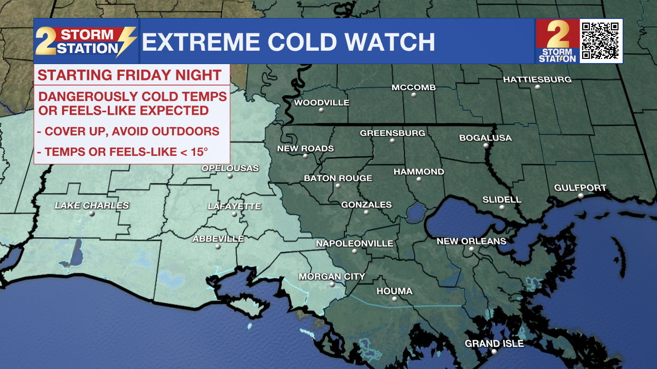
EXTREME COLD WATCH IN EFFECT FROM LATE FRIDAY NIGHT THROUGH SUNDAY MORNING
- WHAT: Dangerously cold wind chills as low as 5 degrees above possible
- WHERE: Much of the Capital Region
- WHEN: Late Friday night through Sunday morning
- IMPACTS: Frostbite and hypothermia can occur with prolonged exposure. Extended periods of freezing temperatures may cause water pipes to rupture.
PRECAUTIONARY ACTIONS:
Dress in layers, including a hat, face mask, and gloves if you must go outside.
Get the latest 7-day forecast and real-time weather updates HERE.
Watch live news HERE.
– Dave
The Storm Station is here for you, on every platform. Your weather updates can be found on News 2, wbrz.com, and the WBRZ WX App on your Apple or Android device. Follow WBRZ Weather on Facebook and X for even more weather updates while you are on the go.
News
