

Latest Weather Blog
Saturday morning video forecast
Related Story
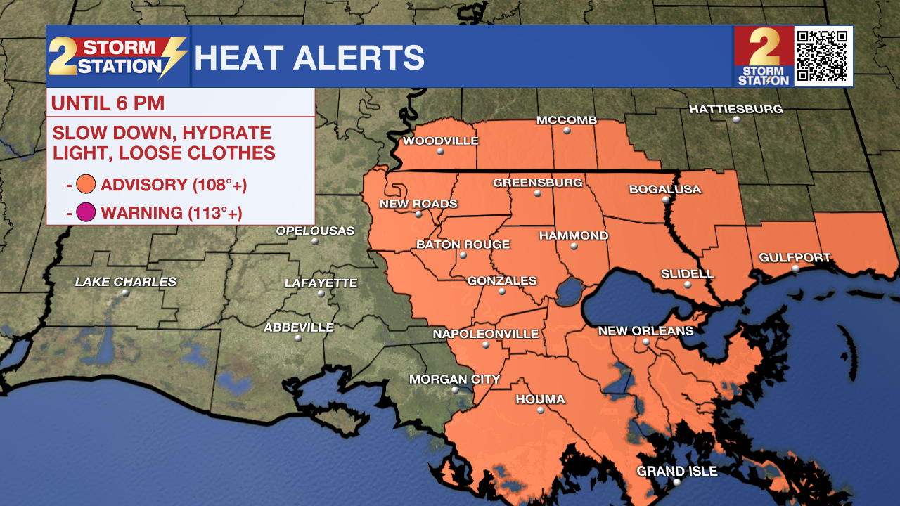
Heat index values will climb to around 110 degrees this weekend, but scattered thunderstorms could still produce localized flooding and isolated severe weather across south Louisiana.

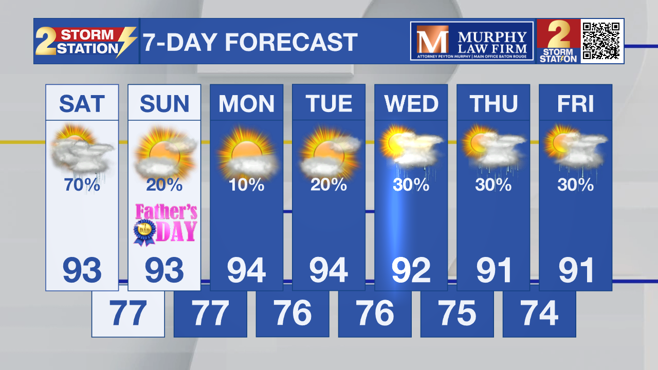
Today and tonight: A Heat Advisory is in effect Saturday afternoon as temperatures climb into the lower and middle 90s. Combined with high humidity, it will feel closer to 105 to 110 degrees in many locations.
At the same time, thunderstorms will develop through the day. Some storms could produce torrential rainfall, leading to localized flooding, especially in areas that received heavy rain earlier this week. A few stronger storms may also produce damaging winds, but flooding will remain the main concern.

Use the slider to advance through the next 24 hours of Futurecast
Up Next: The same general pattern continues Father’s Day with dangerous heat and scattered afternoon thunderstorms. Any storm will be capable of producing heavy rainfall in a short amount of time. But coverage of rain will be considerably less. By Monday and Tuesday, a stronger ridge of high pressure builds across the Gulf Coast. That should reduce rain chances significantly while allowing temperatures and heat index values to climb even higher. Additional Heat Advisories may be needed early next week.
Tropics: The National Hurricane Center is not tracking any areas for tropical development. No tropical cyclone formation is expected across the Atlantic Basin during the next seven days.
Get the latest 7-day forecast and real-time weather updates HERE.
Watch live news HERE.
– Dave
The Storm Station is here for you, on every platform. Your weather updates can be found on News 2, wbrz.com, and the WBRZ WX App on your Apple or Android device. Follow WBRZ Weather on Facebook and X for even more weather updates while you are on the go.
News
