

Latest Weather Blog
Tuesday PM Forecast: rainy night followed by sharply colder temperatures
After a soaking rain Tuesday night, another Arctic air mass takes over. The Capital Area will be facing low wind chills and hard freeze conditions in some areas on Thursday and Friday morning.
Tonight and Tomorrow: Showers will become more numerous through the evening, with widespread rain closer to midnight. Rain will persist into the early overnight before moving out prior to daybreak. A few rumbles of thunder will be possible with this system. Most severe weather should stay offshore, but a few spots of hail are not off the table if any can migrate inland. 1-2” of rain is expected with this system, with isolated amounts up to 3”. Widespread flooding is not a concern, but heavy rain in urban areas could lead to sporadic runoff issues. Aside from a lingering shower early, Wednesday looks largely dry with leftover clouds. A few peeks of sunshine might sneak out late in the day.
Temperatures will drop in a hurry after the steadiest and heaviest rain exits as another Arctic intrusion arrives. As this happens, winds will shift out of the north and accelerate. Temperatures will drop into the mid-40s with wind chills in the upper-30s by sunrise. Daytime temperatures will remain in the 40s on Wednesday with stubborn clouds preventing much warming sunshine. Northerly winds at 10-20 mph and higher gusts will produce feels-like temperatures in the 30s all day. With the warmth experienced in recent weeks, this will likely be a shock to the system.
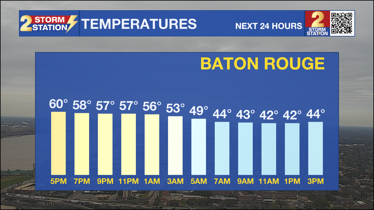
Up Next: Expect bitter cold mornings for the remainder of the workweek. Almost everybody will dip into the 20s on Thursday and Friday mornings. An extended period below freezing will be enough to damage or kill vegetation, especially since they’ve started to wake up during the recent warm stretch. Areas along and north of I-10/12 could see a hard freeze – which would be a problem for pipes. Wind will also be a consideration, with wind chills dropping into the teens and 20s on both mornings. Cold Weather Advisories, at the very least, will be issued soon. Several layers will be needed when going to work or school. Daytime highs will warm into the upper-40s and low-50s.
Trending News
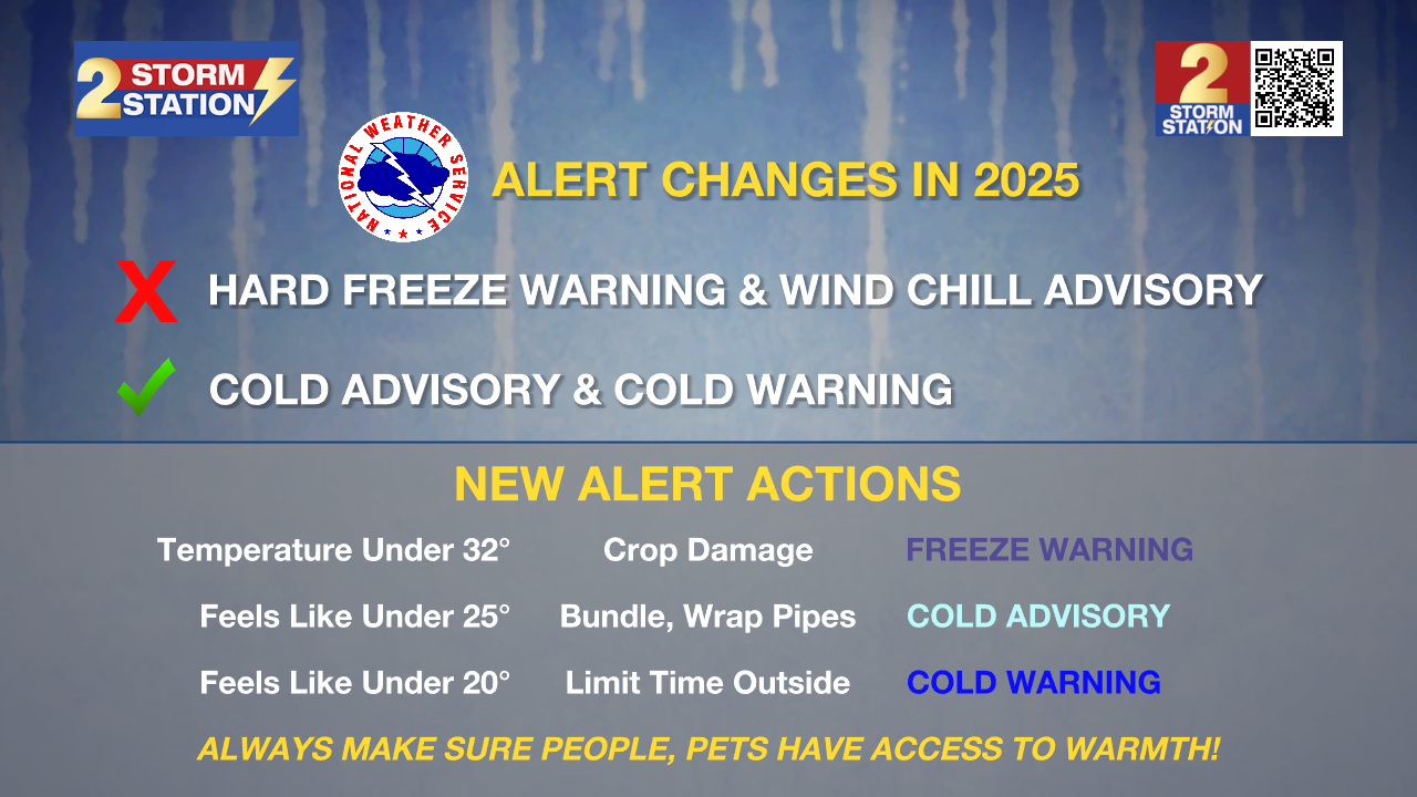
As a reminder, starting this season, NWS has changed the cold weather alerts. You will receive different messages to highlight impacts than during previous winters. Review those changes, including the removal of Hard Freeze Warnings, HERE.
Weekend Outlook: By Saturday night, another weak system could bring some light showers during the evening or overnight. A gradual warmup through the weekend will mean no ice or snow worries. Though no washouts are expected, and both days look largely dry, monitor the forecast for updates as we move into the heart of parade season.
Get the latest 7-day forecast and real-time weather updates HERE.
Watch live news HERE.
The Storm Station is here for you, on every platform. Your weather updates can be found on News 2, wbrz.com, and the WBRZ WX App on your Apple or Android device. Follow WBRZ Weather on Facebook and X for even more weather updates while you are on the go.
More News
