

Latest Weather Blog
Tuesday PM Forecast: dangerous heat holds on before late week pattern switch
Dangerous heat will continue across the Capital Area through Wednesday before a surge of moisture allows afternoon thunderstorms to offer some relief later this week. Know that the pattern could get a little more stormy for afternoon activities this upcoming weekend.
An EXTREME HEAT WARNING is in effect Wednesday for parishes surrounding Lake Maurepas, including southern Tangipahoa, Livingston, Ascension, and St. James. Added humidity from the water will contribute to feels-like temperatures over 113 degrees.
Elsewhere, a HEAT ADVISORY is in place, including Metro Baton Rouge. The heat and humidity combination will result in feels-like temperatures over 108 degrees.
These conditions significantly increase the risk of heat-related illnesses, making heat safety critical. To protect yourself and others, stay in air-conditioned spaces, drink plenty of fluids, limit direct sun exposure, and check in on friends, family, and neighbors. If you must work outdoors, schedule frequent rest breaks in shaded or air-conditioned environments. If someone shows signs of heat stroke or becomes overcome by the heat, move them to a cool location immediately and call 911, as heat stroke is a medical emergency.
Heat Peak: feels-like heat index values topping 108 degrees through Wednesday
Storms Return: afternoon action tapers temperatures Thursday and Friday
Watching the Weekend: not as hot but be prepared to be chased inside by afternoon storms
Trending News

Tonight & This Weekend: Tonight will offer very little relief from the muggy conditions as overnight lows only drop to a warm, sticky 78 degrees. Nighttime lows remaining elevated do contribute to heat danger because buildings do not cool as efficiently and therefore people do not cool as efficiently. Inability to efficiently cool overnight negatively impacts sleep, and good sleep is important to dealing with afternoon heat. These impacts are magnified for anyone without access to air conditioning. Wednesday will start warm, and temperatures will rapidly soar to a high near 97 degrees by the afternoon beneath partly sunny skies. As has been the case lately, a spotty shower will be the exception rather than the rule.
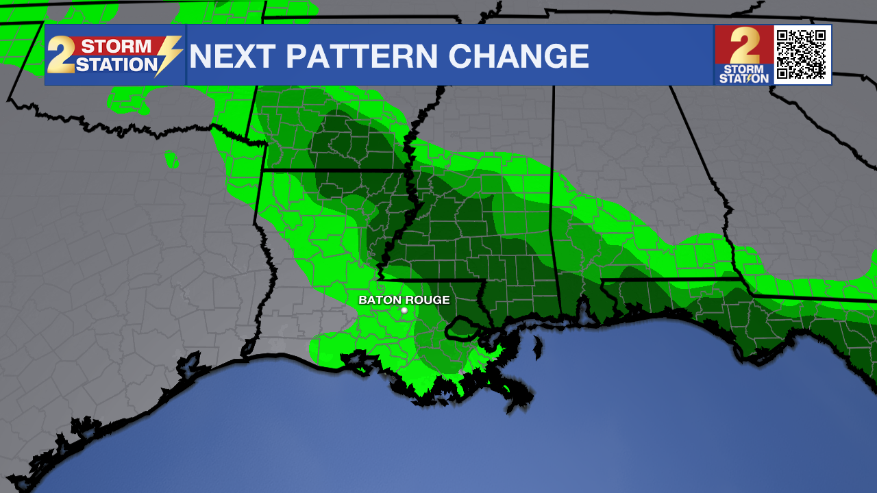
Up Next: An upper-level weather disturbance, a wave of energy moving through the atmosphere that helps trigger showers and thunderstorms, will drop down from the north on Thursday. Isolated showers and thunderstorms will become possible by Thursday afternoon with increasing activity into the weekend. Saturday looks like it could be the most active with scattered action, especially during the afternoon hours. While these showers and thunderstorms will limit the heat, be aware of the possibility that some outdoor activities could be impacted. If downpours hit the same spots on consecutive days, some nuisance street and poor drainage flooding could develop. Weekend temperatures will still be warm and humid, but readings will be seasonable with highs in the low 90s and lows in the low 70s.
Get the latest 7-day forecast and real-time weather updates HERE.
Watch live news HERE.
The Tropics: The Gulf, Caribbean and Atlantic are quiet. No tropical development is expected over the next seven days.
– Josh
The Storm Station is here for you, on every platform. Your weather updates can be found on News 2, wbrz.com, and the WBRZ WX App on your Apple or Android device. Follow WBRZ Weather on Facebook and X for even more weather updates while you are on the go.
More News

