

Latest Weather Blog
Tuesday AM Forecast: Temperatures tumble behind Tuesday night rain
Our next rainmaker arrives Tuesday night, bringing heavy rains and a strong thunderstorm or two to the region. Behind the rain, temperatures tumble and the Capital Area will experience a frigid second half of the workweek.
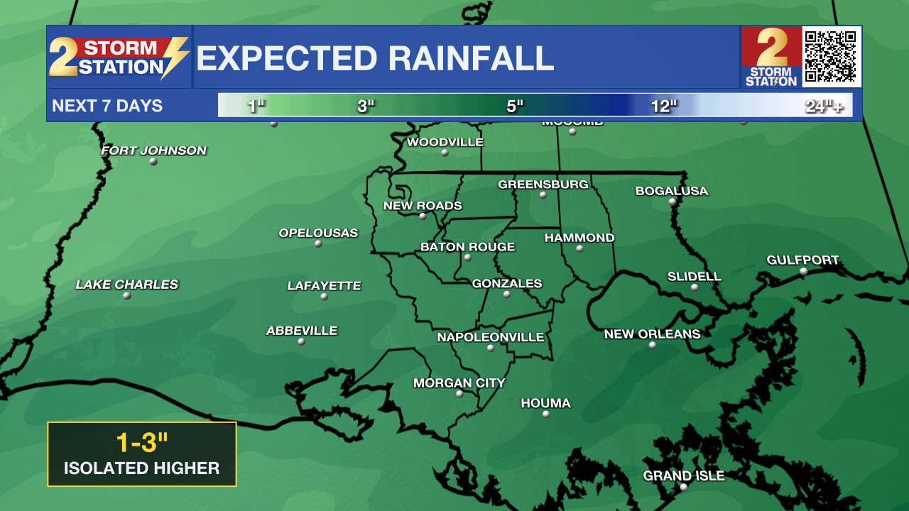
Today & Tonight: Chilly morning conditions under a mix of sun and clouds will turn cool and overcast this afternoon. Look for highs near 60 degrees again today. Besides a spotty shower or two, rain coverage during the day today will be slim. Radar activity is expected to ramp up after sunset in both coverage and intensity as a storm system slides across the Louisiana coast. The majority of thunderstorm activity is expected to stay over Gulf waters, but one or two strong to severe storms may make their way inland overnight. Heavy rainfall and small hail are of the highest concern with this system. From Tuesday night to early Wednesday morning, some areas could collect between 1-3" of rainfall. While flooding isn’t a major concern, heavy rain in urban areas could lead to some localized runoff issues.
By sunrise Wednesday, rain will be exiting to the east. Cloudy skies in addition to a northerly breeze will make for a very chilly morning with temperatures in the 40s.
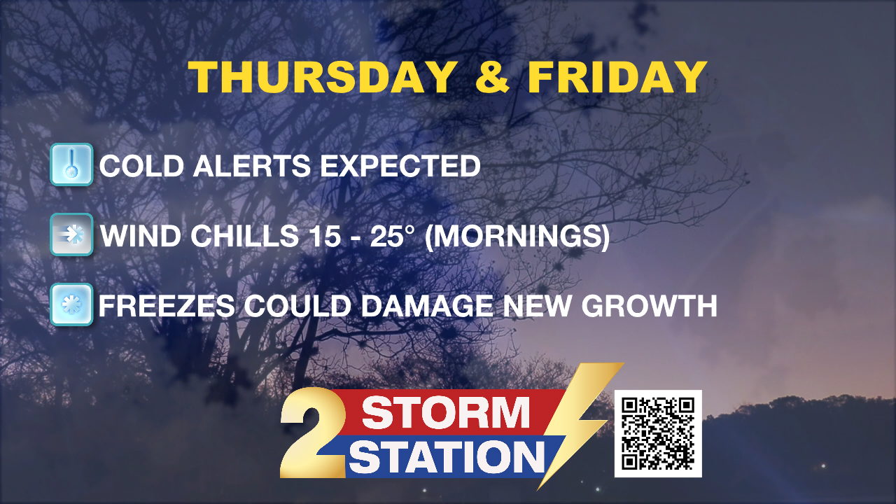
Up Next: With clouds stubborn to break Wednesday, the day will be very chilly with a northerly breeze making conditions feel like temperatures are stuck in the low-40s all day. At the latest, clouds will clear overnight Wednesday and give way to the coldest temperatures the Capital Area has seen in weeks! Thursday and Friday mornings will feature lows in the mid-20s with wind chills even colder. Areas north of I-12 could see a hard freeze, which means temperatures dipping low enough to damage plants and pipes. While this won’t be as brutal as January’s deep freeze, it’ll still be a shock—especially since some plants were already waking up during the recent warm stretch. Expect Cold Weather Advisories to be issued soon. Afternoons to end the workweek will not offer much relief from the cold as highs will struggle to pass the 50-degree mark each day.
Trending News
Weekend Outlook: Another weak system could move along the Gulf Coast on Saturday, bringing isolated showers back to the area. With Carnival season in full swing, take ponchos or umbrellas to any parades over the weekend. Extra layers will also be needed as temperatures on Saturday and Sunday will remain cool. Near to above-average temperatures, in the upper 60s, are set to return next week.
Get the latest 7-day forecast and real-time weather updates HERE.
Watch live news HERE.
– Emma Kate C.
The Storm Station is here for you, on every platform. Your weather updates can be found on News 2, wbrz.com, and the WBRZ WX App on your Apple or Android device. Follow WBRZ Weather on Facebook and X for even more weather updates while you are on the go.
More News
