

Latest Weather Blog
Thursday PM Forecast: cooler air moving in for high school, college football this weekend
Dry air will dominate the Capital Area through the end of the week before a reinforcing cold front brings cooler temperatures for the weekend. While some clouds will pass through at times, the weather looks cooperative for another weekend of football games.
Reinforcing Cool Air: Arriving for the weekendhttps://www.wbrz.com/news/download-the-free-wbrz-weather-app/
Chilliest Morning of the Season (so far): mid-40s expected early Sunday
Uncertainty Next Week: possibility of passing clouds and showers

Trending News
Tonight and Tomorrow: Under mainly clear skies, temperatures will tumble steadily through the 60s during the evening, bottoming out in the low 50s around daybreak. Some high clouds will push in around sunrise on Friday and continue to filter sun at times into the afternoon. Still, temperatures will make a run for the upper 70s and low 80s just ahead of a weak cold front.
Friday Night & Saturday Football Forecast: High school football fans will have crisp, autumn weather Friday evening, with kickoff temperatures in the low 70s sliding into the 60s under mostly clear skies. Saturday afternoon will bring more fall football conditions for both Southern University at A.W. Mumford Stadium and LSU at Tiger Stadium. Expect a mix of clouds and sun with comfortable afternoon highs in the mid-70s. The morning and end of the games will be in the 50s and 60s, respectively so dress in layers so you can add or subtract as needed through the day.
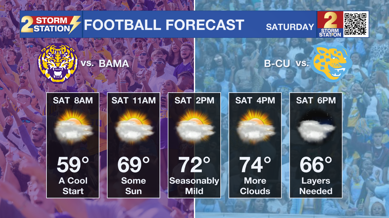
Up Next: A much stronger cold front will push across Louisiana and Mississippi early Saturday. Reinforcing the northerly winds behind this front will allow dry, cool continental air to spill into the region. After waking up to lows in the low 50s on Saturday morning, afternoon highs will struggle to reach the mid-70s. Clouds will be stubborn to break entirely.
Sunday morning will begin with the coldest temperatures of the season so far, in the mid-40s in Baton Rouge, with some rural spots and southwest Mississippi dipping into the lower 40s. Sunday afternoon will stay crisp, topping out in the upper 60s and low 70s with partial sunshine.
Early next week will feature slowly moderating temperatures. A weak storm system will ride over the region with more clouds and possibly a spotty shower Monday through Wednesday, but the vast majority will remain dry, with afternoon highs settling in the mid to upper 70s and lows in the upper 40s.
Get the latest 7-day forecast and real-time weather updates HERE.
Watch live news HERE.
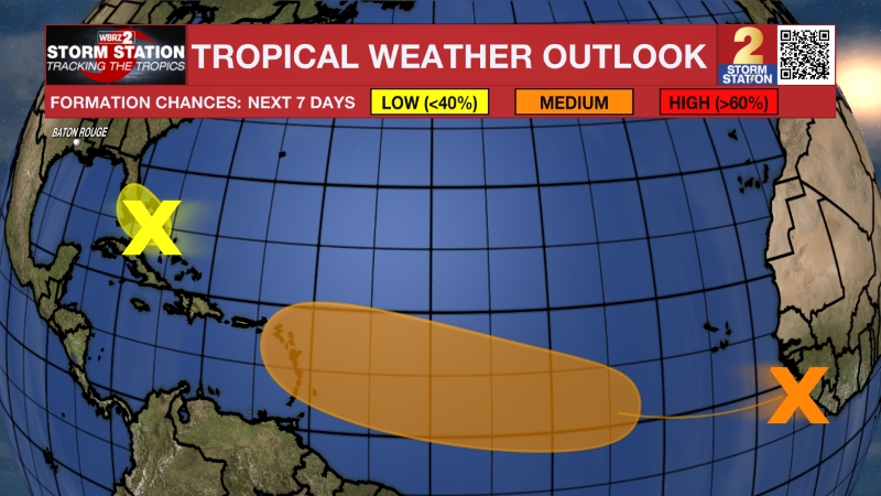
The Tropics: A broad, non-tropical low-pressure system several hundred miles south of Bermuda and drifting east could briefly acquire subtropical features over the next day or two. Regardless of whether it is named, strong upper-level winds will tear it apart by the end of the weekend over open water.
– Josh
The Storm Station is here for you, on every platform. Your weather updates can be found on News 2, wbrz.com, and the WBRZ WX App on your Apple or Android device. Follow WBRZ Weather on Facebook and X for even more weather updates while you are on the go.
More News

