

Latest Weather Blog
Thursday AM Forecast: Warmest temperatures to end the week, Quick cool down behind weekend cold front
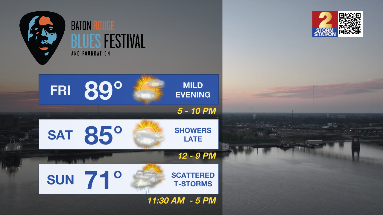
We conclude the workweek with possibly the warmest temperatures of the year so far. A cold front arriving during the second half of the weekend will give short-lived relief from the above average temperatures.
Today & Tonight: Wednesday's overcast conditions continue into the first half of your Thursday. Like the past few days, temperatures early this morning will only fall near 70°, making for another warm and muggy start to the day. Winds remain out of the south, anywhere between 5-10 mph, and with a decent amount of moisture in the atmosphere, we cant rule out a spotty shower popping up during the day today, especially north of I-10/12. There are signals that this afternoon could feature breaks in the clouds and if so, the added sunshine will quickly warm temperatures into the upper 80's for afternoon highs.
Mainly cloudy conditions take us into the overnight hours, but calm winds and a few breaks in the clouds could cool things down a few degrees more than previous days. Low's around the capital area early Friday are forecast near 68°.
Up Next: The best chance to see sunshine over the next few days will be on Friday. As a result in the decline in cloud cover, our forecast high of 89° could warm just enough to meet or beat the record of 90° set back in 2006 and 1987.
Trending News
Going into the weekend, Saturday will conclude the streak of warm and muggy weather for the week with afternoon temperatures in the mid-80's. Saturday will also feature mostly cloudy skies. As a cold front approaches the state from the NW during the day, spotty showers can't be ruled out but numerous showers and thunderstorms arrive Sunday with the passage of the front.
This cold front does not raise the concern for heavy rain or severe weather, though it could put a damper on any outdoor activities on Sunday, especially in the first half of the day. By Sunday evening, the front will continue to push east, with northerly winds behind it bringing in slightly cooler air and noticeable drier air to start the next week. With the rain around on Sunday, temperatures will struggle to warm, Baton Rouge has a forecast high of 71° to end the extremely warm week.
Get the latest 7-day forecast and real time weather updates HERE.
Watch live news HERE.
– Emma Kate Cowan
The Storm Station is here for you, on every platform. Your weather updates can be found on News 2, wbrz.com, and the WBRZ WX App on your Apple or Android device. Follow WBRZ Weather on Facebook and Twitter for even more weather updates while you are on the go.
More News
