

Latest Weather Blog
Saturday PM Forecast: Much cooler air and fire risk after front passage
A ***RED FLAG WARNING*** has been issued from 9am-6pm on Sunday. North winds 15 to 25 mph with gusts up to 35 mph combined with very low relative humidity will cause a fire risk. Any fire that develops will catch and spread quickly. Outdoor burning is not recommended.
Tonight & Tomorrow: We are just about done with the chance of rain as a front pushes through the area this evening. Clouds will quickly clear overnight and temperatures will drop. Expect lows in the mid-40s under clear skies. Sunday will be very breezy, much cooler, and sunny. Highs will top out in the upper 50s.
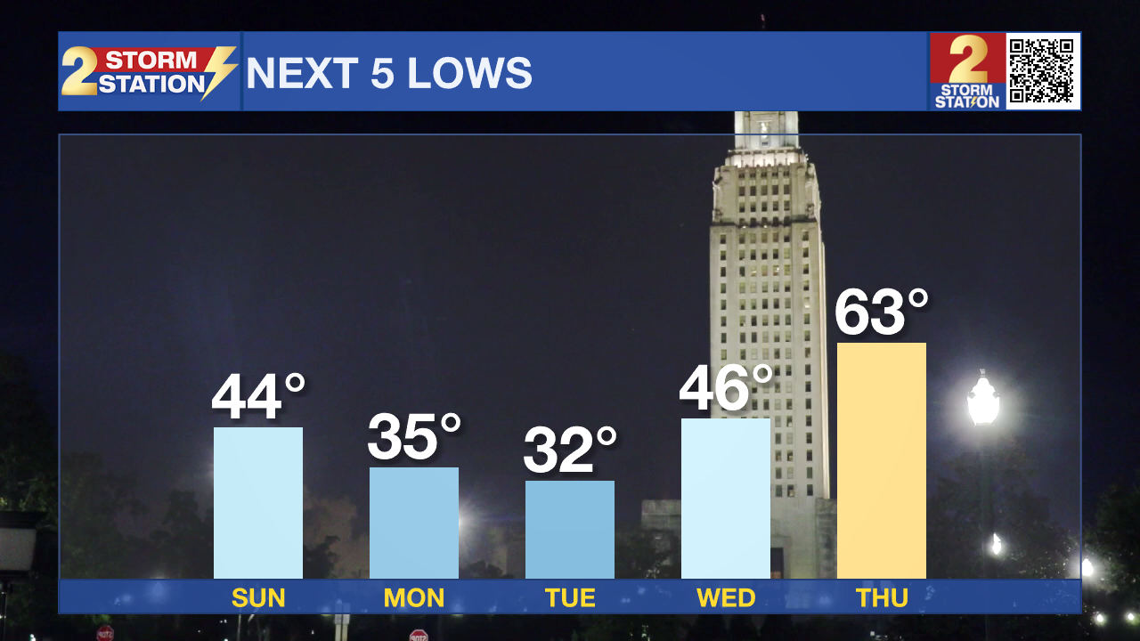
Up Next: Winds will tick down on Monday, but still stay a bit breezy. Cold air will be the main headline early in the week. The coldest morning will be on Tuesday, as many could be dealing with a light freeze. Any sensitive plants will need to be covered or brought indoors. Pipes will be ok this time around. Temperatures will quickly warm midweek as winds flip out of the south. Highs will be in the upper 70s Thursday as another front approaches. This is also where we will see our next best shot at rain. Isolated showers and thunderstorms are expected for now. Any cooldown from this front will be minimal and brief.
Trending News

Get the latest 7-day forecast and real-time weather updates HERE.
Watch live news HERE.
– Balin
The Storm Station is here for you, on every platform. Your weather updates can be found on News 2, wbrz.com, and the WBRZ WX App on your Apple or Android device. Follow WBRZ Weather on Facebook and X for even more weather updates while you are on the go.
More News
