

Latest Weather Blog
Monday AM Forecast: Winter chill returns this week, Next rain arrives late Tuesday
Extra layers will be needed all week long as the winter chill returns to south Louisiana. Our next rainmaker arrives Tuesday night and will deliver an even colder punch of air for the second half of the workweek.
Tonight & Tomorrow: Clear skies on Monday will warm chilly lows that begin in the middle-30s to near 60 degrees this afternoon. Winds will be light today, out of the east, between 5-10 mph. Overnight, clouds will increase and limit Tuesday morning lows to 43° in the Capital City.
Up Next: A few peaks of sunshine may be possible Tuesday morning before overcast skies dominate through the day ahead of our next rainmaker. Look for a high on Tuesday near 60°. Rain chances during the day on Tuesday will remain slim with a significant surge in coverage in showers and storms overnight. A strong storm or two cannot be ruled out, but severe weather is not a high concern with this system.
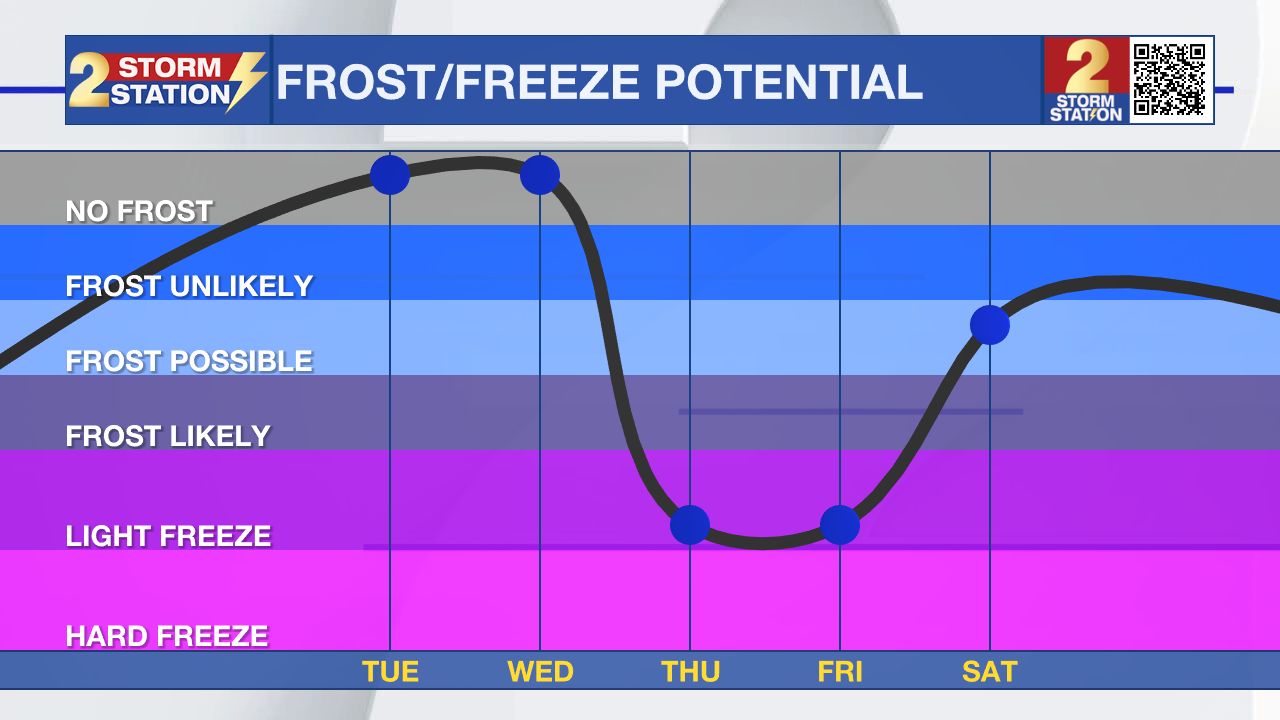
Behind the rain, another push of cold air, possibly the coldest since January, will follow. Clearing skies will move lows into the upper-20s on Thursday and Friday mornings. This could be impactful the cold temperatures could damage or kill sensitive vegetation, especially if plants have begun to leaf out and bloom. A hard freeze cannot even be ruled out in spots. And with a wind to stir things around, cold alerts might be issued. Despite sunshine, afternoons will be chilly with highs in the 40s and 50s.
Trending News
Get the latest 7-day forecast and real-time weather updates HERE.
Watch live news HERE.
-Emma Kate C.
The Storm Station is here for you, on every platform. Your weather updates can be found on News 2, wbrz.com, and the WBRZ WX App on your Apple or Android device. Follow WBRZ Weather on Facebook and X for even more weather updates while you are on the go.
More News
