

Latest Weather Blog
Friday AM Forecast: Temperatures tumbling just in time for another big football weekend
Today will mark the final afternoon in the 80s for at least a few days. A reinforcing front will move through tonight, dropping temperatures just in time for the weekend. With plenty of dry air in place, conditions will cooperate for another big football weekend in the Capital Area.
Today & Tonight: Expect filtered sunshine on Friday, with little more than a few high clouds drifting through from time to time. Temperatures will climb quickly out of the 50s, reaching the upper 70s by lunchtime before topping out in the low 80s by afternoon. Brief clearing will take place this evening as a poorly defined cold front approaches the area. Eventually, more high clouds will fill in overnight. Even after the frontal passage, lows will stay mild in the low-to-mid 50s, with a bigger drop in temperatures holding off until the weekend.

Friday Night & Saturday Football Forecast: Those sitting on the bleachers during the Friday Night Blitz will face a crisp fall feel. With temperatures slipping into the upper 60s by kickoff and dipping into the low-to-mid 60s by the fourth quarter, consider packing a light jacket. The autumn air will stick around on Saturday as both Southern and LSU host home matchups. Conditions will stay dry with mid-70s at kickoff, but mornings will start chilly in the 50s before cooling back into the 60s after the final whistle. Dress in layers that can be added or subtracted as needed.

Up Next: Following a cold front passage Friday night, cooler air will spill into the region. This will keep weekend highs in the 70s, with lows likely tumbling back into the mid-40s by Sunday morning. Rural areas north of I-12 might even dip into the lower 40s. Expect more of the same heading into next week, with temperatures slowly moderating. The main wildcard will be a weak storm system that could bring extra cloud cover at times. That would keep nights a touch milder and knock daytime highs down a degree or two. A stray midweek shower is possible, though the vast majority of the area will stay completely dry.
Trending News
Get the latest 7-day forecast and real-time weather updates HERE.
Watch live news HERE.
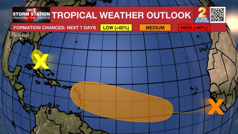
The Tropics: A non-tropical area of low pressure located several hundred miles south of Bermuda is producing a disorganized area of showers and thunderstorms. The complex might acquire subtropical characteristics over the next couple of days while moving east, away from land. The window for possible development will be short, ending by the second half of the weekend.
— Meteorologist Malcolm Byron
The Storm Station is here for you, on every platform. Your weather updates can be found on News 2, wbrz.com, and the WBRZ WX App on your Apple or Android device. Follow WBRZ Weather on Facebook and X for even more weather updates while you are on the go.
More News

