

Latest Weather Blog
Friday AM forecast: Humid Today with Overnight Storm Timing Coming Into Focus
Warm and increasingly humid Friday with storms possible late. Unsettled pattern develops with repeated storm chances through the weekend.

Today & Tonight:
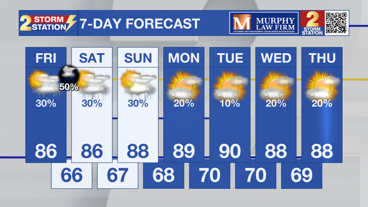
Friday will be warm and more humid with highs climbing into the mid to upper 80s. Most of the day stays dry, but clouds will increase with a chance for showers and thunderstorms developing late this afternoon into the evening. Some of this activity may drift in from the northwest, with stronger storms more likely north of the area, though a few could still bring heavy rain and gusty winds locally.

Use the slider to advance through the next 24 hours of Futurecast
Up Next:
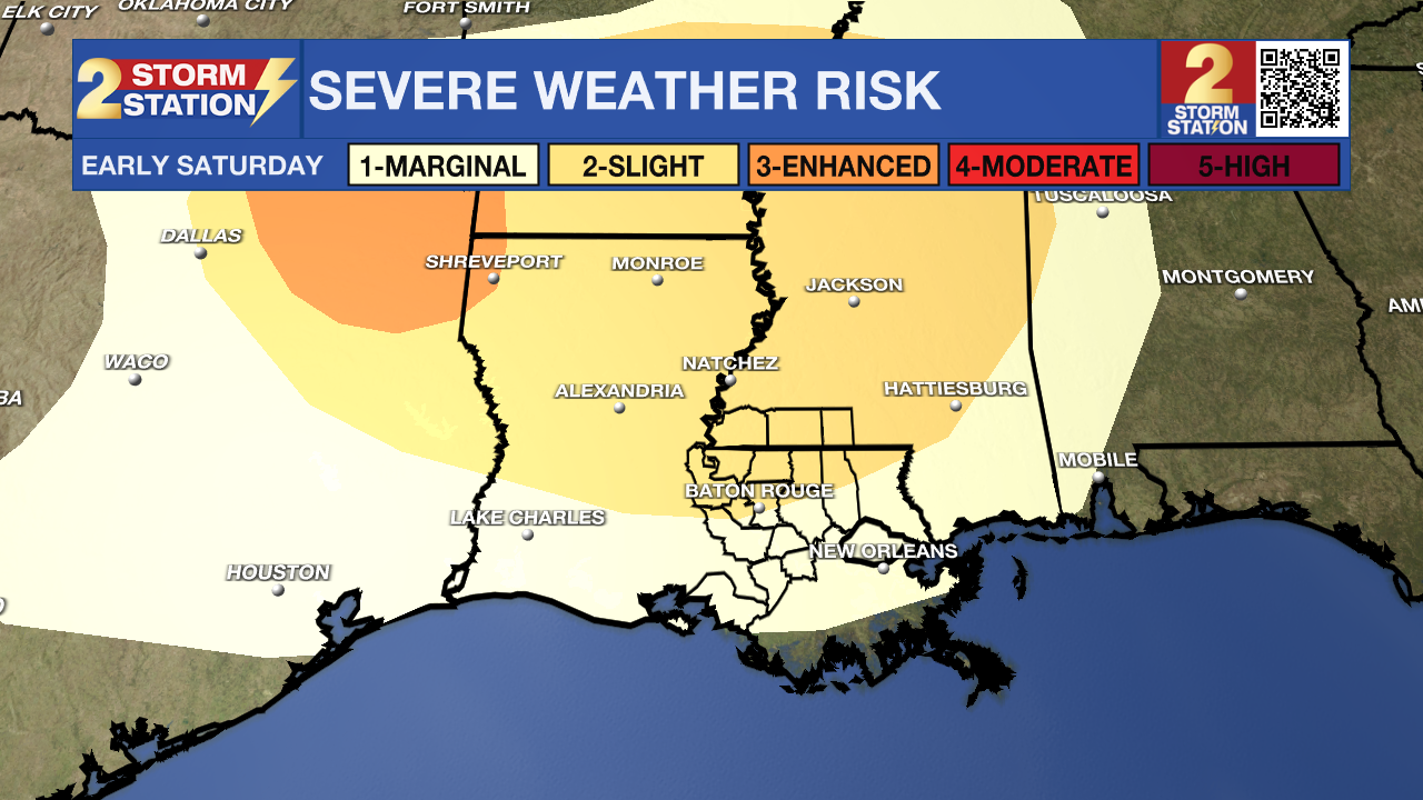
A line of storms is expected to approach the area overnight. A few of these could be strong, although guidance is showing a weakening line as it gets to the Capital region. An unsettled pattern takes hold this weekend as multiple disturbances track along a nearby boundary. This will bring daily chances for showers and thunderstorms Saturday and Sunday, especially during the afternoon and evening hours. Activity may be scattered at times, but a few stronger storms can’t be ruled out.
Trending News
What to Look Out For:
Storm chances will come in waves through the weekend, making exact timing tricky. While not everyone will see rain, any storms that develop could produce brief heavy downpours, lightning, and gusty winds. Looking ahead, rain chances may briefly decrease Monday before heat builds next week, with highs pushing into the upper 80s and lower 90s and heat index values nearing the upper 90s.
Get the latest 7-day forecast and real-time weather updates HERE.
Watch live news HERE.
– Dave
The Storm Station is here for you, on every platform. Your weather updates can be found on News 2, wbrz.com, and the WBRZ WX App on your Apple or Android device. Follow WBRZ Weather on Facebook and X for even more weather updates while you are on the go.
More News
