Heat builds today and peaks by mid-week. A Heat Advisory is in effect today, and even more dangerous conditions are expected Tuesday and Wednesday, with extreme heat possible across parts of south Louisiana.

Today and Tonight: A Heat Advisory is in effect from 11 a.m. until 8 p.m. as afternoon heat index values climb between 105° and 110°. High temperatures will reach the middle to upper 90s under mostly sunny skies, with only an isolated afternoon shower possible. Tonight remains warm and muggy with temperatures only falling into the upper 70s, offering little relief from the ongoing heat.
Up Next: The hottest weather of the week arrives Tuesday and Wednesday. Portions of southeast Louisiana and coastal Mississippi are already under an Extreme Heat Watch for Tuesday, where heat index values could reach 110° to 115°. Additional heat headlines are likely as this prolonged stretch of dangerous heat continues.
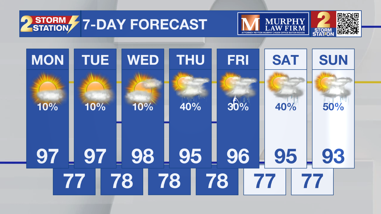
Rain chances remain very low through Wednesday, but a weakening upper ridge and a front settling toward the Gulf Coast will allow scattered afternoon thunderstorms to return Thursday through the weekend. While the storms won't end the summer heat, they'll provide some localized relief heading into next weekend.
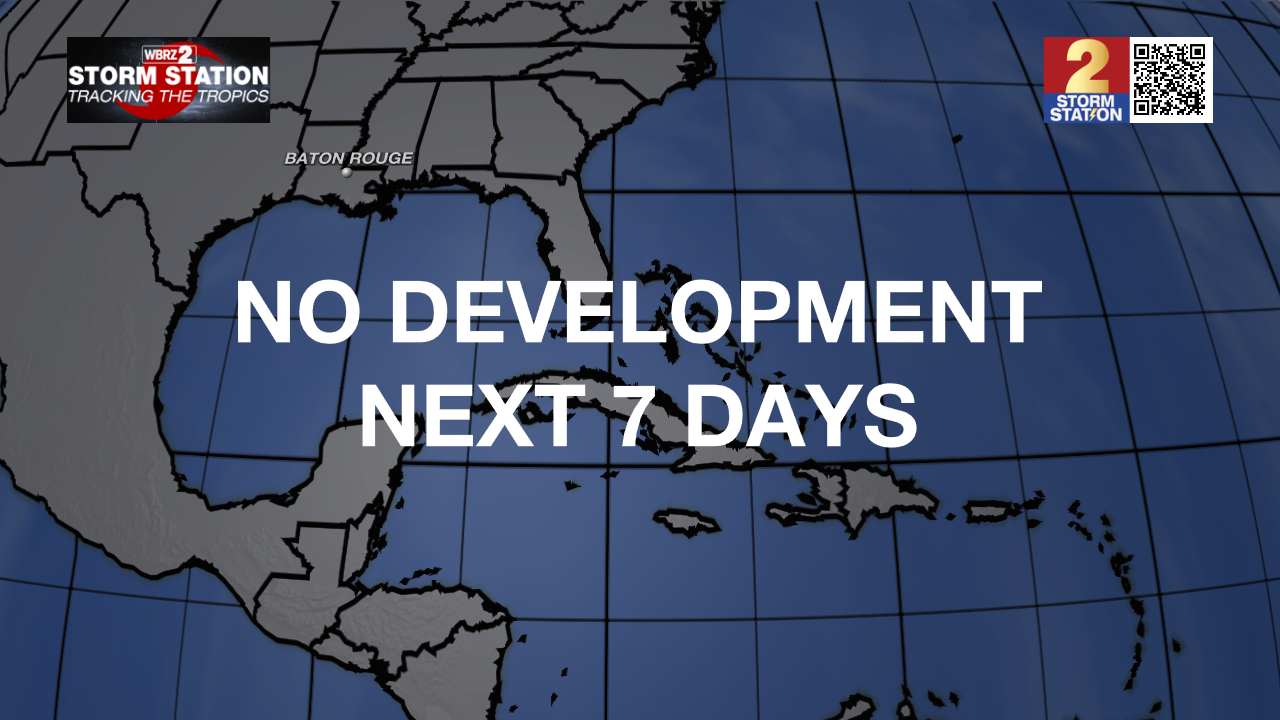
Tropics: The National Hurricane Center is not expecting any tropical cyclone development during the next seven days. Several tropical waves continue moving west across the Atlantic and Caribbean, but none are expected to organize into tropical systems.
Get the latest 7-day forecast and real-time weather updates HERE.
Watch live news HERE.
– Dave
The Storm Station is here for you, on every platform. Your weather updates can be found on News 2, wbrz.com, and the WBRZ WX App on your Apple or Android device. Follow WBRZ Weather on Facebook and X for even more weather updates while you are on the go.