Wednesday Midday Video Forecast
Related Story
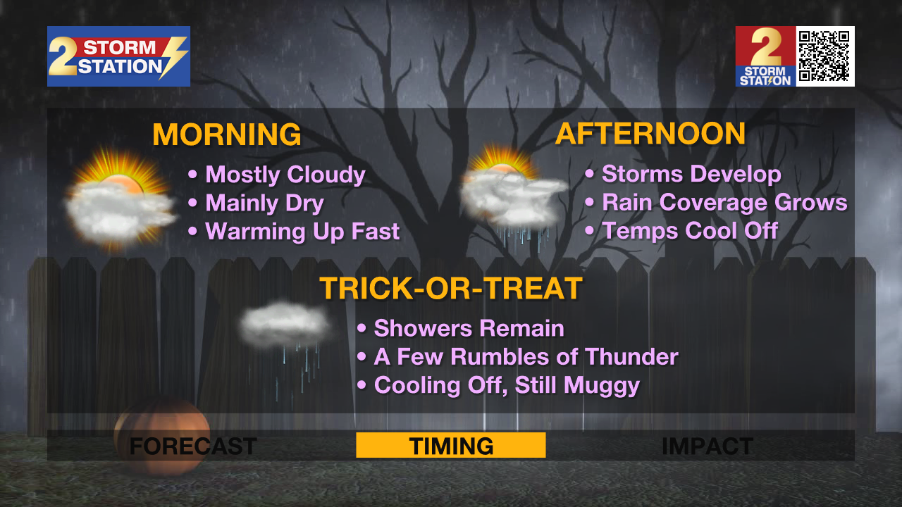
Rain will finally return to the area on Thursday, great news for thirsty lawns but unfortunate for those heading out to trick-or-treat tomorrow afternoon. Keep raingear handy to end the workweek before conditions heat and dry back up over the weekend.
Today & Tonight: Breezy conditions on Wednesday will help keep morning air mixed up enough to limit widespread, dense fog during the morning commute. Some patchy areas may develop but overall morning conditions will be warm and muggy with temperatures barely dipping into the upper-60s around the region. Clouds will increase throughout the day, but not before we mark another near record afternoon high in the upper-80s. Like Tuesday, a few spotty showers may be able to develop before sunset this evening, although most will remain dry until our more impactful rainmaker arrives tomorrow.
Overnight, skies will keep a few clouds around, limiting fog formation and temperatures to the low 70s early Thursday.
Up Next: With ample moisture in the atmosphere and a frontal boundary nearing the state Thursday, we will finally see showers and storms return to the Capital Area after weeks of dry conditions. While exciting, the timing of the rain could not be more unfortunate. Thursday morning will start off mainly dry with mainly cloudy conditions. A few peaks of sun early in the day will allow temperatures to warm in to the middle-80s with a muggy feel. A few spotty showers will be possible Halloween morning though scattered showers and thunderstorms will develop by the afternoon and continue on and off through the evening. For those Trick-or-Treating, it should not be raining at all times, but keep a close eye on the radar as you head out to collect candy. It is also highly advised to keep raingear handy for all outdoor activities tomorrow. As of now, it appears the thunderstorms activity will be diminishing close to nightfall, but make sure to have the Storm Station Weather App activated for nearby lightning notifications, just in case.

The front will not make it to southern Louisiana but instead will stall well to the north on Friday. It's proximity plus the moist atmosphere will likely allow isolated showers and storms to form on Friday. The front will then fall apart over the weekend as conditions in the Capital Area remain muggy and warm. Expect lows in the upper 60s, highs in the upper 80s and a mix of sun and clouds each day. Fog will also be possible Saturday and Sunday mornings as winds calm out.
Get the latest 7-day forecast and real time weather updates HERE.
Watch live news HERE.

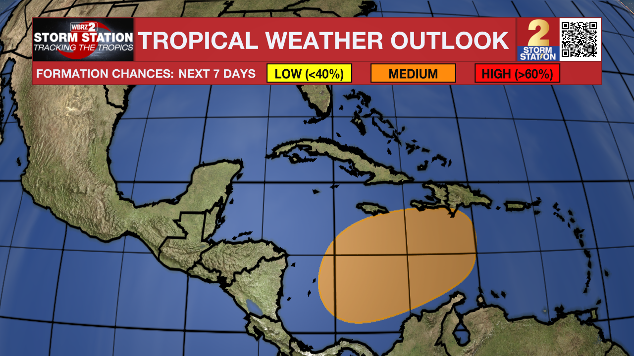
The Tropics: A broad area of low pressure is likely to develop over the southwestern Caribbean Sea in a couple of days. Gradual development is possible thereafter, and a tropical depression could form over the weekend while the system begins to drift northward or northeastward toward the central Caribbean Sea.
– Emma Kate C.
The Storm Station is here for you, on every platform. Your weather updates can be found on News 2, wbrz.com, and the WBRZ WX App on your Apple or Android device. Follow WBRZ Weather on Facebook and Twitter for even more weather updates while you are on the go.


